Area Overview for Kirkby Cross & Portland Ward
Photos of Kirkby Cross & Portland Ward

Area Information
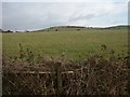
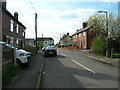
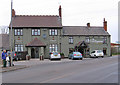
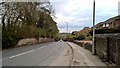
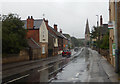
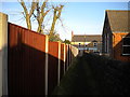
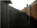
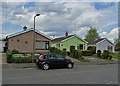
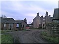
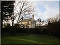
Kirkby Cross & Portland Ward sits within the Ashfield district council in Nottinghamshire, covering a compact area of 5.9 km². This ward was centred around coordinates 53.093789, -1.280441 and included approximately 1,474 households in 2011. The location forms part of the modern administrative boundaries and boasts the Kirkby Cross Conservation Area as a focal point for local heritage. You will find significant local landmarks here, including Kirkby Cross Hall, which stands as a notable feature of the landscape. Orchard Primary & Nursery School serves the educational needs of families within this district. Daily life in Kirkby Cross & Portland Ward revolves around historic elements such as the Old Chapel Close, open footpaths, and Castle Hill. These features provide residents with immediate access to walking routes and established green spaces. The ward map released by Ashfield Council details these boundaries, confirming the scope of the community. Living in this area means engaging with a setting defined by these specific physical structures and natural topographies. There is no surrounding Ramsar wetland, Area of Outstanding Natural Beauty, or protected nature reserve within the ward boundaries. Consequently, the character of the neighbourhood is shaped primarily by the conservation area and its associated historic assets rather than broader protected landscapes. Homes near these specific locations offer a connection to the landscape without the strict planning constraints often found near designated natural reserves. The area maintains a distinct identity through its integration of school facilities, conservation zones, and historic halls.
- Area Type
- District Borough Unitary Ward
- Area Size
- 5.9 km²
- Population
- Not available
- Population Density
- Not available
Demographics
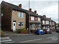
The community in Kirkby Cross & Portland Ward has an older demographic profile, characterised by a median age of 70 years. This statistic indicates that the population skews significantly towards retirement-age residents. Most common age data available confirms this general trend, though specific breakdowns for sub-groups are not detailed in the current dataset. Consequently, living in Kirkby Cross & Portland Ward often involves interacting with an established, mature population rather than a youthful demographic. The area also registers a relatively high level of home ownership, with 78% of residents owning their properties outright or with a mortgage. This figure ranks above the national average for many parts of the United Kingdom. Because home ownership stands at 78%, the majority of people in Kirkby Cross & Portland Ward have settled into long-term residences. This stability typically means fewer flat migrations and a quieter local atmosphere. While the household composition is recorded in the total data, the high ownership rate suggests a preference for owner-occupied housing over rental accommodation. The ethnic diversity and religious breakdown of the area are recorded in the total population figures, but specific breakdowns are not highlighted here. The ageing population and high ownership rate combine to create a neighbourhood where residents are likely to be deeply embedded in the local community. You might find that services cater more to older adults, shaping the daily rhythm of life for anyone choosing homes in Kirkby Cross & Portland Ward.
Household Size
Accommodation Type
Tenure
Ethnic Group
Religion
Household Composition
Age
Household Deprivation
NS-SEC
Explore more demographic insights in this area
Go to Demographics tabPlanning
Planning Constraints
- Flood RiskPremium
- Ramsar Wetland SitesPremium
- Area of Outstanding Natural BeautyPremium
- Protected Nature ReservePremium
- Crime RiskPremium