Area Overview for Kirk Langley
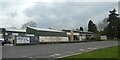
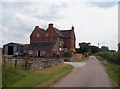
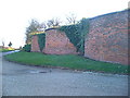
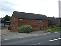
Photos of Kirk Langley
Area Information
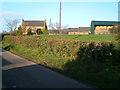
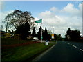
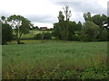
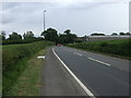
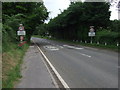
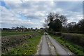
Living in Kirk Langley offers a quiet life within a defined land area measuring just 10.3 square kilometres. This civil parish presents itself as a compact community where residents navigate daily routines without the density of larger towns. The simplicity of the location appeals to those seeking a retreat from urban noise while maintaining connection to the wider English countryside. You will find a setting where space is not a premium commodity but a standard feature of your surroundings. The parish structure indicates a level of local governance focused specifically on the needs of this small population. Daily existence here revolves around the intrinsic qualities of the land itself rather than commercial development. There are no large retail parks or heavy industry to disrupt the rhythm of park life or evening walks. The scale of 10.3 square kilometres allows for easy exploration on foot or by bicycle if you own such a vehicle. You can traverse significant distances without feeling overwhelmed by traffic or noise pollution. This environment suits individuals who value peace and prefer to structure their leisure time around nature rather than scheduled entertainment. The area stands apart as a distinct entity within the broader regional landscape. Its identity remains tied to its rural roots rather than trends in urban regeneration. You are buying into a history that has remained largely unchanged by modern speculation. The lack of complex planning constraints suggests that future growth will remain careful and measured. Residents here enjoy a lifestyle defined by stability and a deep connection to the land that surrounds their homes.
- Area Type
- Parish
- Area Size
- 10.3 km²
- Population
- Not available
- Population Density
- Not available
Demographics
The community in Kirk Langley reflects a settled population with a median age of seventy years old. This figure indicates that the parish is predominantly home to retirees who have chosen this location for their later years. You will encounter a neighbourhood where long-term residents know one another and share a history of living in the same spot for decades. Households in this area typically consist of couples or individuals who have downsized from busy city homes. Almost eighty percent of residents own their homes outright or with a mortgage. This high rate of home ownership creates a community with significant stability and low turnover rates. You are likely to stay near the same neighbours for many years as opposed to moving every few years. The demographic profile excludes the transient population found in student hubs or commuter areas. Instead, you find a community focused on comfort and belonging rather than rapid change. The age profile shows that the total population falls firmly within the senior bracket. Shopping habits in Kirk Langley will mirror this reality, with a strong demand for good value and practical services. You will find supermarkets or community centres that cater to older shoppers who require assistance or clear communication. Local businesses have adapted to serve an audience that prioritises utility over fashion trends. This age concentration means you will not find a vibrant youth culture dominating the streets at weekends. The social fabric is built on generations who have remained static in the parish rather than migrating frequently. Your neighbours are likely to be people who have lived here for thirty years or more. This stability fosters a sense of security that is rare in more dynamic urban locations. The community functions as a close-knit group where everyone shares the same understanding of local history and values.
Household Size
Accommodation Type
Tenure
Ethnic Group
Religion
Household Composition
Age
Household Deprivation
NS-SEC
Explore more demographic insights in this area
Go to Demographics tabPlanning
Planning Constraints
- Flood RiskPremium
- Ramsar Wetland SitesPremium
- Area of Outstanding Natural BeautyPremium
- Protected Nature ReservePremium
- Protected WoodlandPremium