Area Overview for Kingston on Soar
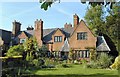
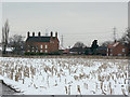
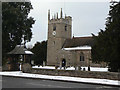
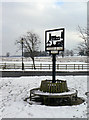
Photos of Kingston on Soar


Area Information
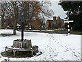
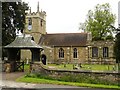
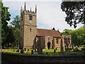
Living in Kingston on Soar offers a distinct experience within a civil parish covering an area of 5.2 square kilometres. This settlement stands apart from major urban centres due to its compact scale and specific demographic profile. The community is characterised by a deep-seated focus on residential stability rather than transient urban living. You will find a location where daily life revolves around local rather than distant amenities, shaping a lifestyle that prioritises established routines. The parish nature of the area defines a boundary and a sense of place that remains consistent with its historical roots. Residents navigate a space where the physical environment supports a slower pace of life compared to larger neighbouring towns. The small size of the zone means that community interactions often occur within close proximity of your home. This geographic reality fosters a neighbourhood dynamic where the boundaries of the parish directly influence your daily commute and access to facilities. When considering homes in Kingston on Soar, you are entering a market defined by long-term settled populations. The area does not boast the sprawling infrastructure of larger cities, which influences the types of houses and developments available. Instead, the focus remains on existing stock that accommodates the current population structure. The distinct identity of the parish ensures that changes to the landscape are gradual and considerate of local character. You should expect a living environment where the size of the area dictates a quieter atmosphere, away from the noise and congestion of metropolitan routes. Understanding the 5.2 kilometre square you inhabit provides immediate context for the scale of your proposed home.
- Area Type
- Parish
- Area Size
- 5.2 km²
- Population
- Not available
- Population Density
- Not available
Demographics
The community profile in Kingston on Soar presents a clear picture of an older demographic. The median age stands at 70 years, indicating that a significant portion of the population comprises retired residents or those in their later life stages. This age skew shapes the demand for housing, prioritising single-level living and accessibility over dynamic family growth. You will find that the social fabric is woven around the needs and interests of older generations creating a quieter, less frenetic neighbourhood environment. Household composition reflects this demographic reality, with fewer young families or multi-generational young households compared to younger towns. Home ownership rates in Kingston on Soar reach 77 per cent, demonstrating a strong preference for property ownership over renting. This high percentage suggests a stable community where long-term residents have secured their tenure. The predominance of owner-occupiers contributes to lower turnover rates and a sense of permanence. While specific ethnic and religious statistics are not detailed in the current records, the singular demographic focus on age dominates the cultural landscape. You should prepare for a social environment that is inherently older than the national average. This does not necessarily limit lifestyle options but defines the primary activities and community engagements. The high rate of homeownership ensures that most neighbours are likely to be mortgage-free or approaching that stage, fostering a specific type of community cohesion.
Household Size
Accommodation Type
Tenure
Ethnic Group
Religion
Household Composition
Age
Household Deprivation
NS-SEC
Explore more demographic insights in this area
Go to Demographics tabPlanning
Planning Constraints
- Flood RiskPremium
- Ramsar Wetland SitesPremium
- Area of Outstanding Natural BeautyPremium
- Protected Nature ReservePremium
- Protected WoodlandPremium
- Crime RiskPremium