Area Overview for Kingsthorpe South Ward
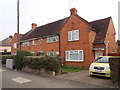
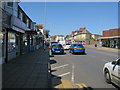
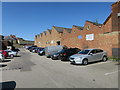
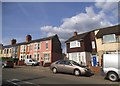
Photos of Kingsthorpe South Ward

Area Information
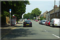
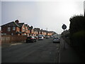
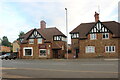
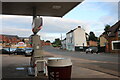
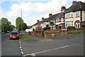
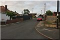
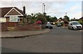
Kingsthorpe South Ward is a compact district ward within Northampton, covering an area of 3.6 km² with a resident population of 1,837. This community sits roughly 2 miles north-north-west of Northampton town centre, retaining a strong sense of history that dates back to the Domesday Survey of 1085. The ward's character is defined by its historic core, which centres on the village green and the 12th-century Church of St John the Baptist. This area was designated as a Conservation Area in 1971, protecting its heritage with boundaries extended later to include Vicarage Lane and Kingswell Road. You will find notable landmarks such as Home Farm, a 17th-century stone house featuring a listed dovecote and barn, alongside the Kingsthorpe Recreation Ground which has hosted cricket and football since 1912. Living in Kingsthorpe South Ward offers a connection to the past while providing access to modern amenities like the 1974 Kingsthorpe Shopping Centre. The proximity to the Northampton and Leicester railway line and the A508 and A5199 roads ensures the area remains well-connected despite its rural parish origins.
- Area Type
- District Borough Unitary Ward
- Area Size
- 3.6 km²
- Population
- 1837
- Population Density
- 509 people/km²
Demographics
The demographic profile of Kingsthorpe South Ward shows a community with a significant proportion of older residents, as the median age for the area is 70. This elevated age figure suggests a neighbourhood where many inhabitants enjoy their retirement years. Regarding housing tenure, 57% of residents own their homes outright or with a mortgage, indicating a stable environment where the majority have settled permanently rather than renting. The ward contains a total household composition, with accommodation types and predominant ethnic groups recorded against the total population. While the specific breakdown of household sizes is available only as a total category, the high home ownership rate points towards families and retirees who have established long-term roots. Deprivation metrics are not included in the current dataset, meaning you cannot determine the extent of financial hardship within this specific ward. Instead, the data highlights a community with solid property ownership. The population density stands at 509 people per km², reflecting a moderately compact living arrangement for a district of its size.
Household Size
Accommodation Type
Tenure
Ethnic Group
Religion
Household Composition
Age
Household Deprivation
NS-SEC
Explore more demographic insights in this area
Go to Demographics tabPlanning
Planning Constraints
- Flood RiskPremium
- Ramsar Wetland SitesPremium
- Area of Outstanding Natural BeautyPremium
- Protected Nature ReservePremium
- Protected WoodlandPremium
- Crime RiskPremium