Area Overview for Kingsthorpe North Ward
Photos of Kingsthorpe North Ward

Area Information
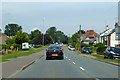
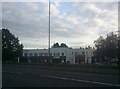
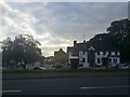
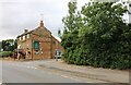
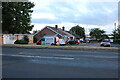
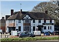
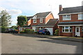
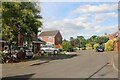
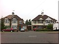
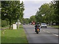
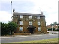
Kingsthorpe North Ward sits as a distinct suburban district within Northampton, covering 3.1 square kilometres in the West Northamptonshire constituency. Although the ward population was recorded at 4,477 in 2011, the area continues to function as a residential extension of the northern suburbs. You will find yourself situated along the A508 and A5199 roads, which provide direct routes to Northampton town centre and further destinations like Leicester and Market Harborough. The locality balances modern suburban expansion with the preserved character of its historic core. At the centre of the original village, the Church of St John the Baptist stands as a 12th-century landmark, anchoring a green space that retains a semi-rural feel. This historic charm contrasts with the more recent developments that have pushed northwards and alongside the main arteries. Living in Kingsthorpe North Ward means accessing local amenities such as the Kingsthorpe Shopping Centre, which opened in 1974 and houses major retailers like Waitrose and Asda. The Kingsthorpe Recreation Ground, known locally as The Rec, was acquired in 1912 and offers a dedicated space for sports and leisure. This area has evolved from its 1086 origins as a royal demesne hamlet into a established residential neighbourhood where daily life revolves around these specific community hubs and transport links.
- Area Type
- District Borough Unitary Ward
- Area Size
- 3.1 km²
- Population
- Not available
- Population Density
- Not available
Demographics
The community within Kingsthorpe North Ward displays a clear demographic profile shaped by its residential nature. The median age for residents stands at 70 years, placing this ward among the older districts in the region. This age profile suggests a population dominated by retired individuals or long-term residents rather than young families or single professionals. You should note that 79% of households in Kingsthorpe North Ward are owner-occupied, indicating a high level of local stability and rootedness. This figure is significantly higher than many parts of the country where rental properties dominate the landscape. Because of this high ownership rate and older median age, the ward functions as a community of settled homeowners. The data indicates that accommodation types and household compositions align with a mature demographic, though specific breakdowns for these categories are not detailed in the current records. For buyers interested in the local community, the environment reflects a quarter largely free of institutional renters or transient populations. The stable ownership levels mean that neighbourhood turnover is likely lower, fostering consistent local governance and community engagement. This demographic reality shapes the area into a quiet, established zone distinct from transit hubs or student concentrations.
Household Size
Accommodation Type
Tenure
Ethnic Group
Religion
Household Composition
Age
Household Deprivation
NS-SEC
Explore more demographic insights in this area
Go to Demographics tabPlanning
Planning Constraints
- Flood RiskPremium
- Ramsar Wetland SitesPremium
- Area of Outstanding Natural BeautyPremium
- Protected Nature ReservePremium
- Protected WoodlandPremium