Area Overview for King's Norton
Photos of King's Norton
Area Information
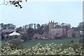
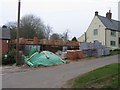
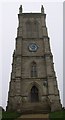
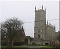
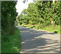
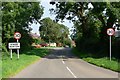
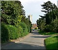
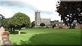
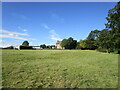
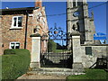
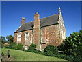
King's Norton is a small civil parish situated in the West Midlands of England, covering a compact area of 4.1 km². The location offers a defined character from the outset, making it distinct from larger neighbouring settlements. Living in King's Norton means engaging with a tightly bound community where the scale of the parish influences daily life and proximity to local amenities. You will find homes in an environment that prioritises stability, with a setting that has remained consistent over time. The area does not stretch over vast distances, which means residents often know one another well and maintain close ties to the immediate neighbourhood. This is a place where the footprint is small but the sense of belonging is deep. Prospective buyers looking for a quiet, established environment will appreciate the clear boundaries and the lack of sprawling development within the parish limits. The parish structure provides a clear administrative identity, separating it from surrounding urban zones while maintaining accessibility to wider facilities.
- Area Type
- Parish
- Area Size
- 4.1 km²
- Population
- Not available
- Population Density
- Not available
Demographics
The community within King's Norton possesses a notably mature demographic profile, with the median age standing at 70 years. This figure indicates that the majority of residents are in the later stages of life, creating a neighbourhood heavily weighted towards older households. When you look at household composition and accommodation types in the parish, the data reflects this demographic reality through high levels of stability rather than transient activity. Home ownership rates are substantial, accounting for 74% of the total households in the area. Such a high ownership percentage suggests that many residents have deeply rooted interests in King's Norton and are likely to remain there for the long term. You are unlikely to encounter significant turnover in the housing market, as a large proportion of the population lives in their own homes. The age profile and ownership levels combine to form a settled society where the tempo of life moves more slowly. Those considering homes in King's Norton should expect a population that values consistency and where social interactions are often based on long-standing local connections.
Household Size
Accommodation Type
Tenure
Ethnic Group
Religion
Household Composition
Age
Household Deprivation
NS-SEC
Explore more demographic insights in this area
Go to Demographics tabPlanning
Planning Constraints
- Flood RiskPremium
- Ramsar Wetland SitesPremium
- Area of Outstanding Natural BeautyPremium
- Protected Nature ReservePremium
- Protected WoodlandPremium