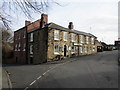
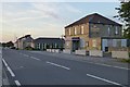
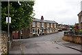
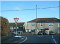
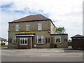
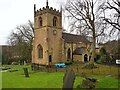
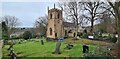
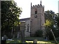
Area Overview for Killamarsh East Ward
Photos of Killamarsh East Ward
Area Information
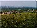
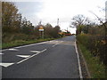
Living in Killamarsh East Ward offers a distinct experience within the borough unitary ward of South Yorkshire. This district covers a total land area of 3.3 km², creating a compact neighbourhood where daily commutes and local interactions are manageable. The area is defined by its mature character and specific planning constraints that shape the built environment. You will find no protected nature reserves or Areas of Outstanding Natural Beauty within these boundaries, which simplifies planning discussions for potential future developments. However, the presence of protected woodland does introduce a specific planning constraint that developers must navigate around. Daily life here feels settled and established. The ward sits at the heart of a residential zone where the immediate surroundings are free from major flood risk, with low coverage posing a threat to property values or lifestyle. The absence of Ramsar wetland sites further reduces environmental restrictions compared to more sensitive coastal or riverine locations. For anyone considering homes in Killamarsh East Ward, the physical geography suggests a stable foundation without the ecological red tape found in protected zones. The area balances urban convenience with the quiet of established green spaces, making it a practical choice for residents who prioritise straightforward ownership over expansive conservation landscapes. You can explore the streets with confidence that the land designation remains clear of high-risk environmental certifications while maintaining access to local greenery.
- Area Type
- District Borough Unitary Ward
- Area Size
- 3.3 km²
- Population
- Not available
- Population Density
- Not available
Demographics
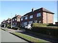
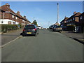
The community profile of Killamarsh East Ward reflects a distinctly mature population. The median age stands at 70, indicating that the majority of residents are comfortable retirees or older adults. This demographic concentration shapes the local economy and social fabric, creating an environment where community engagement often revolves around leisure, health, and family support rather than young professional nightlife. When you choose to live in Killamarsh East Ward, you join a neighbourhood where the typical household consists of established families or single older individuals. Home ownership is the dominant feature of this community, with 70% of residents owning their homes outright or with a mortgage. This high rate of ownership suggests deep community roots and financial stability among local families. The remaining 30% likely consists of landlords renting to tenants, though the primary dynamic remains owner-occupied. The data does not specify detailed breakdowns for ethnicity or religion, but the overall demographic picture points towards a traditional, senior-focused community. Understanding these figures helps you grasp the pace of life and the types of neighbours you might expect. A 70-year-old median age means local schools near Killamarsh East Ward will primarily cater to younger residents or those living elsewhere, as the immediate population skew is firmly towards older age groups.
Household Size
Accommodation Type
Tenure
Ethnic Group
Religion
Household Composition
Age
Household Deprivation
NS-SEC
Explore more demographic insights in this area
Go to Demographics tabPlanning
Planning Constraints
- Flood RiskPremium
- Ramsar Wetland SitesPremium
- Area of Outstanding Natural BeautyPremium
- Protected Nature ReservePremium
- Protected WoodlandPremium
- Crime RiskPremium