Area Overview for Kibworths Ward
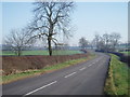
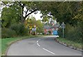
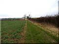
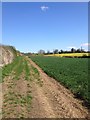
Photos of Kibworths Ward
Area Information
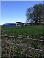
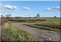
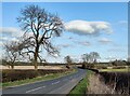
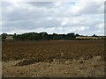
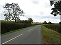
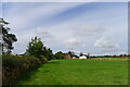
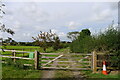
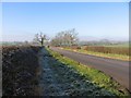
Kibworths Ward is a distinct electoral ward situated within the Harborough district of Leicestershire. This area encompasses the civil parishes of Kibworth Beauchamp and Kibworth Harcourt, which the data defines as being divided by the Midland Main Line railway. The total coverage spans 46.0 km², hosting a population of 2,286 residents. You find this community located near Market Harborough, Leicester, and Foxton Locks, at approximately 52.54°N, 1.00°W. The history of the area dates back to the late thirteenth century when Walter de Merton purchased much of Kibworth Harcourt parish, creating a lasting link to Merton College, Oxford. Daily life here reflects a quiet character with a population density of 50 people per square kilometre. The ward contains notable landmarks including the Grade II* listed St Wilfrid's Church and Kibworth Harcourt Mill, which stands as the last surviving post mill in Leicestershire. Recent restoration work on the mill took place between 2020 and 2021. Local history includes the village school founded in 1709 and famous residents such as writer Anna Laetitia Barbauld and Sir Nicholas Harold Lloyd Ridley. The area also boasts a cricket club with significant success, including national championships. Transport connections rely on the Arriva Midlands Sapphire route X3 and the Stagecoach Midlands route X7, as rail access via the former Kibworth station closed in 1968. If you are seeking homes in Kibworths Ward, you are looking at a location with deep roots and specific planning constraints related to protected woodland.
- Area Type
- District Borough Unitary Ward
- Area Size
- 46.0 km²
- Population
- 2286
- Population Density
- 50 people/km²
Demographics
The community within Kibworths Ward presents a very specific age profile, with a median age of 70 years. This figure indicates a population composed significantly of older residents rather than young families or students. The demographic data lists the most common age range simply as 'Age: Total', confirming that the overall ageing trend is the dominant feature of the social landscape. You should expect a neighbourhood where the majority of households consist of older individuals. Home ownership is the prevailing form of tenure in this area, with a staggering 76% of residents owning their property outright or with a mortgage. This high rate suggests a stable community established over several decades rather than a transient rental market. The remaining 24% likely comprises private tenants or those renting from local authorities. The provided data notes sections for household composition, accommodation type, predominant ethnic group, and religion, but does not supply specific breakdowns for these categories. Consequently, the visible statistic of high ownership stands out as the primary demographic indicator. When considering living in Kibworths Ward, the social fabric is defined by this large cohort of owners aged around 70 years. The lack of specific data on diversity or religious affiliation means the demographic picture relies heavily on the age and ownership metrics which are clearly available.
Household Size
Accommodation Type
Tenure
Ethnic Group
Religion
Household Composition
Age
Household Deprivation
NS-SEC
Explore more demographic insights in this area
Go to Demographics tabPlanning
Planning Constraints
- Flood RiskPremium
- Ramsar Wetland SitesPremium
- Area of Outstanding Natural BeautyPremium
- Protected Nature ReservePremium
- Protected WoodlandPremium
- Crime RiskPremium