Area Overview for Kibworth Harcourt
Photos of Kibworth Harcourt


Area Information
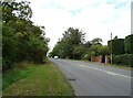
Kibworth Harcourt is a civil parish within the Harborough district of Leicestershire, covering a total area of 6.1 km². This northern part of the larger Kibworth settlement sits on the eastern side of the A6 Leicester Road, approximately seven miles north-west of Market Harborough. While the area functions as a single planning unit with Kibworth Beauchamp, Kibworth Harcourt retains its own distinct identity and conservation area. The medieval core of the village has remained substantially unchanged since medieval times, offering a sense of continuity that attracts those seeking traditional surroundings. A flat-topped mound with surrounding ditch, possibly a Norman motte, survives south of the High Street where markets were historically held. The A6 now bypasses much of the historic village centre, separating the ancient streets from modern thoroughfares. You will find yourself in a setting where history is visible in the architecture and landscape. The parish includes the Grade I listed Kibworth Harcourt Post Mill, which the Society for the Protection of Ancient Buildings restored between 2020 and 2021. It also contains The City, an unusually named cluster of historic dwellings on a lane off Albert Street. Living in Kibworth Harcourt means engaging with a location where medieval origins and Norman heritage form the foundational character of daily life. The community profile of Kibworth Harcourt reveals a settlement defined by older residents rather than young families or transient workers. The median age in Kibworth Harcourt stands at 70 years, indicating a population skewed significantly towards later life stages. Most household compositions and accommodation types reflect this demographic reality, though specific breakdowns for these categories are not detailed in available records. You should expect to meet neighbours who have lived in Kibworth Harcourt for decades, contributing to a stable and established social fabric. Home ownership is the dominant form of accommodation, with 78% of households owning their property outright or with a mortgage. This high rate suggests that the area is primarily composed of long-term residents who have invested in their homes over time. Specific figures on deprivation, ethnicity, religion, and the most common age range within the total population are not recorded in the current dataset. Consequently, you cannot assess income levels or ethnic diversity with precision at this time. The known fact remains that the area is overwhelmingly owner-occupied. This ownership model often correlates with community commitment and local stewardship, which may influence how residents manage shared spaces like the conservation areas surrounding The Old House and Garden Walls on Main Street. The housing stock in Kibworth Harcourt is characterised by a strong tendency towards home ownership, with 78% of households recording as owner-occupied. This statistic indicates that the market is less driven by student rentals or short-term tenancies compared to areas with high institutional leasing. Instead, the demand for homes in Kibworth Harcourt is likely dominated by individuals seeking to settle in a village with a clear conservation designation. Much of the property stock comprises older dwellings, including the Grade II* listed The Old House and Garden Walls at 33 Main Street, and clusters like The City off Albert Street. These areas feature mud-and-thatch cottages recorded from the 18th century onwards, suggesting a significant supply of historic properties. A substantial residential development of 549 dwellings was planned for the area adjacent to Kibworth, with 271 delivered as of March 2014. While much of this expansion falls within the broader settlement, the original core remains defined by its medieval roots. Buyers looking at Kibworth Harcourt should anticipate properties that reflect centuries of architectural evolution rather than modern housing estates. The high ownership rate implies that sellers in Kibworth Harcourt are often looking to downsize or move on after long periods of residence, rather than speculative investors flipping modern builds. Digital connectivity in Kibworth Harcourt presents a mixed picture for remote workers and daily commuters. Mobile network quality scores 83 out of 100, which indicates good coverage for most carriers across the 6.1 km² parish. In contrast, fixed broadband quality scores 67 out of 100. This gap suggests that while you will rarely lose signal during a call or walk through the village, internet speeds may vary depending on your specific property and internet service provider. For those considering living in Kibworth Harcourt, relying solely on mobile data for video calls or heavy office work may introduce occasional frustrations. There is no functioning passenger railway station in the village; the East Midlands Trains line passes through, but it has not served Kibworth since 1968. You will need to use the A6 Leicester Road to reach nearby towns, which currently bypasses the historic centre. Specific journey times to major cities are not provided, but the location approximately nine miles south-east of Leicester city centre places it within reasonable driving distance. Transport by bus is not detailed in available sources, so you may need to rely on private vehicles for most daily journeys. Residents of Kibworth Harcourt benefit from a predominantly safe environment with low risk across key categories. The area holds a safety score of 79 out of 100, confirming that crime rates are below the national average. This assessment reflects a neighbourhood where you can expect lower than average incidents of anti-social behaviour or property crime. Environmentally, the parish faces no significant planning constraints that would typically depress property values or require costly mitigation. There is no Ramsar wetland sites coverage, no Area of Outstanding Natural Beauty coverage, and no protected nature reserve coverage within the boundary. Additionally, there is no protected woodland on the land, simplifying any future landscaping or garden management. The flood risk assessment also passes with a low level, scored at 4.06 out of 100 where lower indicates less risk. This confirms low flood risk coverage, meaning you are unlikely to face insurance premiums or maintenance issues associated with water saturation. The motte in Hall Field is a Grade II* scheduled monument, contributing to the area's historic interest without imposing modern planning restrictions. Living in Kibworth Harcourt offers peace of mind regarding both physical security and environmental stability. What is the typical age of people living in Kibworth Harcourt?The median age in Kibworth Harcourt is 70 years. This high figure indicates that the community is dominated by older residents. You will find a population that has likely lived in the area for a considerable time, contributing to a stable and familiar local environment. How strong is the internet connection in the village?Mobile coverage in Kibworth Harcourt scores 83 out of 100, which is good for staying connected on the go. Fixed broadband scores 67 out of 100, which is acceptable but may not support heavy video streaming or large file transfers for every household. Specific ISP speeds depend on your location. Is Kibworth Harcourt a safe place to live for families?The area has a low crime risk assessment with a score of 79 out of 100. This indicates below-average crime rates compared to the rest of the country. Additionally, the flood risk is low, scoring just 4.06 out of 100, ensuring environmental safety for residents. What makes the property market in Kibworth Harcourt unique?Home ownership is very common, with 78% of households owning their property. This high rate suggests a market comprised of long-term residents rather than landlords. Many homes are historic, including Grade I listed mills and 18th-century cottages within the conservation areas.
- Area Type
- Parish
- Area Size
- 6.1 km²
- Population
- Not available
- Population Density
- Not available
Demographics
The community profile of Kibworth Harcourt reveals a settlement defined by older residents rather than young families or transient workers. The median age in Kibworth Harcourt stands at 70 years, indicating a population skewed significantly towards later life stages. Most household compositions and accommodation types reflect this demographic reality, though specific breakdowns for these categories are not detailed in available records. You should expect to meet neighbours who have lived in Kibworth Harcourt for decades, contributing to a stable and established social fabric. Home ownership is the dominant form of accommodation, with 78% of households owning their property outright or with a mortgage. This high rate suggests that the area is primarily composed of long-term residents who have invested in their homes over time. Specific figures on deprivation, ethnicity, religion, and the most common age range within the total population are not recorded in the current dataset. Consequently, you cannot assess income levels or ethnic diversity with precision at this time. The known fact remains that the area is overwhelmingly owner-occupied. This ownership model often correlates with community commitment and local stewardship, which may influence how residents manage shared spaces like the conservation areas surrounding The Old House and Garden Walls on Main Street. The housing stock in Kibworth Harcourt is characterised by a strong tendency towards home ownership, with 78% of households recording as owner-occupied. This statistic indicates that the market is less driven by student rentals or short-term tenancies compared to areas with high institutional leasing. Instead, the demand for homes in Kibworth Harcourt is likely dominated by individuals seeking to settle in a village with a clear conservation designation. Much of the property stock comprises older dwellings, including the Grade II* listed The Old House and Garden Walls at 33 Main Street, and clusters like The City off Albert Street. These areas feature mud-and-thatch cottages recorded from the 18th century onwards, suggesting a significant supply of historic properties. A substantial residential development of 549 dwellings was planned for the area adjacent to Kibworth, with 271 delivered as of March 2014. While much of this expansion falls within the broader settlement, the original core remains defined by its medieval roots. Buyers looking at Kibworth Harcourt should anticipate properties that reflect centuries of architectural evolution rather than modern housing estates. The high ownership rate implies that sellers in Kibworth Harcourt are often looking to downsize or move on after long periods of residence, rather than speculative investors flipping modern builds. Digital connectivity in Kibworth Harcourt presents a mixed picture for remote workers and daily commuters. Mobile network quality scores 83 out of 100, which indicates good coverage for most carriers across the 6.1 km² parish. In contrast, fixed broadband quality scores 67 out of 100. This gap suggests that while you will rarely lose signal during a call or walk through the village, internet speeds may vary depending on your specific property and internet service provider. For those considering living in Kibworth Harcourt, relying solely on mobile data for video calls or heavy office work may introduce occasional frustrations. There is no functioning passenger railway station in the village; the East Midlands Trains line passes through, but it has not served Kibworth since 1968. You will need to use the A6 Leicester Road to reach nearby towns, which currently bypasses the historic centre. Specific journey times to major cities are not provided, but the location approximately nine miles south-east of Leicester city centre places it within reasonable driving distance. Transport by bus is not detailed in available sources, so you may need to rely on private vehicles for most daily journeys. Residents of Kibworth Harcourt benefit from a predominantly safe environment with low risk across key categories. The area holds a safety score of 79 out of 100, confirming that crime rates are below the national average. This assessment reflects a neighbourhood where you can expect lower than average incidents of anti-social behaviour or property crime. Environmentally, the parish faces no significant planning constraints that would typically depress property values or require costly mitigation. There is no Ramsar wetland sites coverage, no Area of Outstanding Natural Beauty coverage, and no protected nature reserve coverage within the boundary. Additionally, there is no protected woodland on the land, simplifying any future landscaping or garden management. The flood risk assessment also passes with a low level, scored at 4.06 out of 100 where lower indicates less risk. This confirms low flood risk coverage, meaning you are unlikely to face insurance premiums or maintenance issues associated with water saturation. The motte in Hall Field is a Grade II* scheduled monument, contributing to the area's historic interest without imposing modern planning restrictions. Living in Kibworth Harcourt offers peace of mind regarding both physical security and environmental stability. What is the typical age of people living in Kibworth Harcourt?The median age in Kibworth Harcourt is 70 years. This high figure indicates that the community is dominated by older residents. You will find a population that has likely lived in the area for a considerable time, contributing to a stable and familiar local environment. How strong is the internet connection in the village?Mobile coverage in Kibworth Harcourt scores 83 out of 100, which is good for staying connected on the go. Fixed broadband scores 67 out of 100, which is acceptable but may not support heavy video streaming or large file transfers for every household. Specific ISP speeds depend on your location. Is Kibworth Harcourt a safe place to live for families?The area has a low crime risk assessment with a score of 79 out of 100. This indicates below-average crime rates compared to the rest of the country. Additionally, the flood risk is low, scoring just 4.06 out of 100, ensuring environmental safety for residents. What makes the property market in Kibworth Harcourt unique?Home ownership is very common, with 78% of households owning their property. This high rate suggests a market comprised of long-term residents rather than landlords. Many homes are historic, including Grade I listed mills and 18th-century cottages within the conservation areas.
Household Size
Accommodation Type
Tenure
Ethnic Group
Religion
Household Composition
Age
Household Deprivation
NS-SEC
Explore more demographic insights in this area
Go to Demographics tabPlanning
Planning Constraints
- Flood RiskPremium
- Ramsar Wetland SitesPremium
- Area of Outstanding Natural BeautyPremium
- Protected Nature ReservePremium
- Protected WoodlandPremium
- Crime RiskPremium