Area Overview for Kibworth Beauchamp
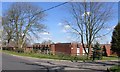
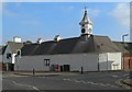
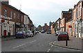
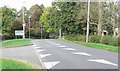
Photos of Kibworth Beauchamp

Area Information
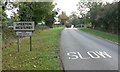
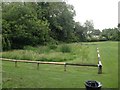
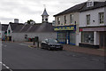
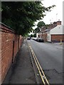
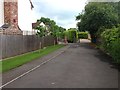
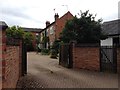
Kibworth Beauchamp is a civil parish situated within England, covering a small area of 5.2 km². Living in this location means embracing a rural setting that remains distinctly English rather than urban. The parish functions as a local community with its own distinct identity, separate from larger town centres. Residents here experience daily life shaped by the constraints and benefits of a small population centre. There is no large town high street immediately within the parish boundaries. You will find yourself surrounded by open space and fields rather than dense housing blocks. This setting appeals to those seeking a quieter pace of life away from city noise and congestion. The small footprint of 5.2 km² limits scale but increases a sense of place. Every road and field within the parish boundaries is part of this intimate environment. You are never far from nature, whether walking your dog or simply stepping outside your front door. The distinct character of the parish contrasts sharply with the sprawling metropolises found elsewhere in the United Kingdom. It is a place where neighbours know each other, and the community feels close-knit. If you are considering homes in Kibworth Beauchamp, prepare for a lifestyle defined by tranquility and limited infrastructure. The town centre is small and functional, serving local needs without the vibrancy of a city hub. Your days will be filled with fresh air rather than traffic fumes. This reality defines the experience of living in Kibworth Beauchamp for anyone moving from a larger urban area. The compact nature of the parish ensures that everything is within walking or cycling distance for many residents.
- Area Type
- Parish
- Area Size
- 5.2 km²
- Population
- Not available
- Population Density
- Not available
Demographics
The community within Kibworth Beauchamp reflects a settled population with a median age of 70 years. This figure indicates that the area attracts older residents who have put down roots. Most of the population falls into the older age bracket, suggesting a retirement destination or a community where many people move later in life. You will encounter a demographic where life experience is common and families with young children may be less frequent. The age profile shapes the local culture, shopping needs, and social activities available within the parish. Home ownership stands at 76 per cent across the parish. This high percentage signals a neighbourhood where people stay put for decades rather than renting or moving frequently. The accommodation type data confirms that most households own their residences outright or with a mortgage. You will see fewer short-term lettings or shared houses compared to student areas or large cities. The household composition remains consistent with the older demographic, often featuring empty nests returned home by working children or couples in retirement. Diversity metrics show total ethnicity and religion data recorded without a specific dominant group named in the statistics. The population is not defined by a single faith or ethnic minority, reflecting a traditional mix found in many rural English parishes. This lack of a predominant group often results in a culturally neutral environment where tradition meets individuality. Deprivation patterns are not explicitly quantified in the current records, so quality of life is assessed through ownership stability rather than poor economic indicators. The 76 per cent ownership rate suggests financial stability within the community.
Household Size
Accommodation Type
Tenure
Ethnic Group
Religion
Household Composition
Age
Household Deprivation
NS-SEC
Explore more demographic insights in this area
Go to Demographics tabPlanning
Planning Constraints
- Flood RiskPremium
- Ramsar Wetland SitesPremium
- Area of Outstanding Natural BeautyPremium
- Protected Nature ReservePremium
- Protected WoodlandPremium