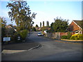
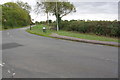
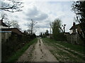
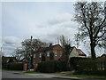
Area Overview for Keyworth & Wolds Ward
Photos of Keyworth & Wolds Ward


Area Information
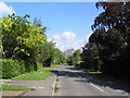
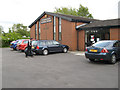
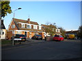
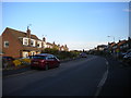
Resting within the South Kesteven district of Lincolnshire sits Keyworth & Wolds Ward, covering a compact 26.4 km² of land. The area accommodates a population of 2,498 residents, resulting in a residential density of 95 people per square kilometre. This figures places the ward among the most contested parts of the Borough of Lincolnshire regarding population density. Living in Keyworth & Wolds Ward feels distinctly rural due to these low-density figures, yet you are served by robust digital infrastructure. The area presents a straightforward profile without complex planning constraints or significant environmental hazards. You can find homes in Keyworth & Wolds Ward where the primary focus remains on established neighbourhoods rather than new development restrictions. Daily life here is defined by a clear separation between managed risks and the quiet practicality of village living. The lack of protected nature reserves or woodland indicates that the landscape management is governed by standard local planning rather than heritage designations. This simplicity appeals to buyers seeking a defined footprint for their investment. The ward's identity is built on stability rather than rapid growth, evidenced by its established demographic profile. Prospective buyers looking for a settled region will find the specific boundaries of this ward offer a predictable environment for long-term residence.
- Area Type
- District Borough Unitary Ward
- Area Size
- 26.4 km²
- Population
- 2498
- Population Density
- 95 people/km²
Demographics
The community in Keyworth & Wolds Ward distinguishes itself through a sharply defined age profile. The median age of residents stands at 70 years, which places the area well into the category of a mature adult community. Most common age ranges cluster significantly higher than the national average, reflecting a population dominated by retirees and older adults. This demographic reality shapes the local demand for specific services and leisure facilities within the ward. Home ownership rates remain exceptionally high, with 83% of households owned outright. This figure confirms that Keyworth & Wolds Ward is practically an owner-occupied zone rather than a rental market. The data shows almost no presence of private renting or social housing within the recorded statistics for this area. You can expect a community where assets are held personally rather than leased. This high concentration of homeowners often correlates with stability in the local economy and a slower property turnover rate. While the data does not specify predominant ethnic groups or religious affiliations, the demographic homogeneity suggests a traditional lifestyle. The absence of specific household composition details aside, the sheer dominance of older age groups creates a distinct social rhythm. Residents here share life stages that often lead to active participation in older adult organisations or local community groups. Understanding that you are buying into an area where the average neighbour is likely retired is essential for your expectations.
Household Size
Accommodation Type
Tenure
Ethnic Group
Religion
Household Composition
Age
Household Deprivation
NS-SEC
Explore more demographic insights in this area
Go to Demographics tabPlanning
Planning Constraints
- Flood RiskPremium
- Ramsar Wetland SitesPremium
- Area of Outstanding Natural BeautyPremium
- Protected Nature ReservePremium
- Protected WoodlandPremium
- Crime RiskPremium