Area Overview for Kettering
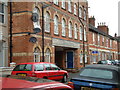
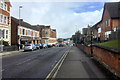
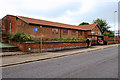
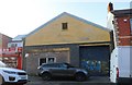
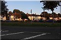
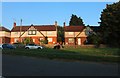
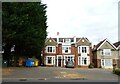
Photos of Kettering


Area Information
Living in Kettering offers a distinct experience defined by its compact scale and mature character. This built-up area covers 16.1 km², making it a contained town where distances are manageable. With a population of 17,836, the community retains the feel of a neighbourhood rather than a sprawling conurbation. You will find that daily life here revolves around a steady pace, supported by an established infrastructure designed for local connectivity. The density averages 1,109 people per square kilometre, reflecting a residential focus without being excessively congested. Prospective buyers often note that Kettering functions as a practical base for those seeking stability within Northamptonshire. The town's footprint allows for easy access to the amenities listed near the Interchange and Railway Station. You do not need to drive far to reach essential services, which contributes to a self-sufficient lifestyle. The area attracts individuals who value a settled environment over rapid urban expansion. This demographic focus shapes the streetscapes and public spaces throughout the 16.1 km² boundary. Residents appreciate the balance between community familiarity and the convenience of staying within a single borough. Whether you are exploring homes in Kettering for retirement or creating a family base, the town provides a contained setting with reliable access to wider transport networks.
- Area Type
- Built Up Area 250
- Area Size
- 16.1 km²
- Population
- 17836
- Population Density
- 1109 people/km²
Daily life in Kettering revolves around a selection of high-street amenities within practical reach of your home. You can shop at Tesco Kettering Windmill for groceries and household needs, relying on local stock rather than long trips to out-of-town malls. Tesco Kettering on the main high street offers additional retail choices for broader purchases. For those preferring co-ops, Co-op Kettering provides an alternative option for food and daily essentials. These three supermarket locations ensure that your weekly shopping is convenient regardless of where you live in the town. Beyond retail, the transport network feeds directly into your lifestyle by connecting you to the Bus Interchange for local travel. The Rail station, known as Kettering Railway Station, offers regular departures for commuters and visitors. You will find that the concentration of these facilities keeps errands manageable within a short walking or driving distance. The presence of multiple Tesco stores and a Co-op means you rarely need to leave the immediate town boundary for daily necessities.
Amenities
Schools
Families considering schools near Kettering will find a concentration of institutions serving the immediate neighbourhood. Avondale Infant School serves the junior age group within the catchment, followed by Avondale Junior School which completes the primary education pathway for local children. You will also find Hawthorn Community Primary School operating nearby, providing additional primary education options. For younger children, Ronald Tree Nursery School offers early years education close to residential areas. Henry Gotch Junior School completes the list of key providers in this vicinity. The presence of these specific schools means that local families have access to a network of primary institutions without needing to look further afield immediately. The mix includes infant and junior phases, catering to children from early years through to age 11. While secondary schools are not listed in the immediate proximity data, the primary options listed provide a solid foundation for early education. Parents in Kettering can enrol their children in Avondale Infant School or move them to Avondale Junior School as they progress through the curriculum. The variety of school types, including community and infant/junior splits, offers flexibility for families settling in the area.
| Rank | School | Type | Entry gender | Ages |
|---|
Explore more schools in this area
Go to Schools tabDemographics
The community in Kettering displays a clear demographic maturity that influences the social fabric of the town. You will encounter a resident population with a median age of 70, indicating a significant portion of older adults have settled in this area. This age profile suggests a neighbourhood where stability and long-term residency are common features. Sixty-three percent of homes are owner-occupied, contrasting with newer urban developments that often rely heavily on renting. This high rate of ownership points to a population invested in their local properties and looking to stay. Household composition data indicates that the area supports a wide range of family structures, from single-person households to multi-generational living. The accommodation types available cater to these established patterns, matching the needs of a 70-year-old median age group. While the area has seen changes over recent decades, the current makeup remains consistent with a mature town centre. You will find that the streets are populated by individuals who have lived in Kettering for many years. This consistency creates a predictable environment where community roles are well understood. The demographic data reveals a town where retirement living and established families coexist, defining the rhythm of local life.
Household Size
Accommodation Type
Tenure
Ethnic Group
Religion
Household Composition
Age
Household Deprivation
NS-SEC
Explore more demographic insights in this area
Go to Demographics tabPlanning
Planning Constraints
- Crime RiskPremium