Area Overview for Isham
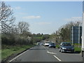
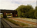
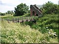
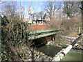
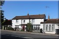
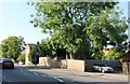
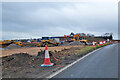
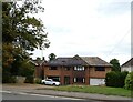
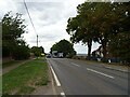
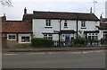
Photos of Isham


Area Information
Living in Isham offers a distinctly quiet lifestyle within a built-up area spanning 33.5 hectares. This village functions as a peaceful residential pocket rather than a bustling town centre, appealing to those who prioritise calm over convenience. The median age of 70 years signals that this community is largely composed of older residents. You will find a population where stability is the norm, with 80 per cent of households owning their homes outright. Daily life revolves around a slower pace, suited to retirees or empty nesters seeking a serene environment. The area does not offer the dynamic energy of a large city or even a busy suburban hub. Instead, it presents a streamlined living experience for those who value space and tranquility. Prospective buyers considering homes in Isham should expect a setting where neighbours know one another well, and community life moves at a gentle rhythm. While shopping trips and leisure activities require travel to nearby towns, the trade-off is a pristine, low-density living environment. This location works best for you if your daily routine revolves around local walks rather than commute-heavy town centre visits. The area's character is defined by its modest size and its specific demographic composition, creating a homogenous and familiar atmosphere.
- Area Type
- Built Up Area 250
- Area Size
- 33.5 hectares
- Population
- Not available
- Population Density
- Not available
Your daily lifestyle in Isham will be shaped by the range of amenities located within practical reach. The area offers five retail outlets in its vicinity, specifically Sainsburys Burton, Budgens Barton, and Aldi Pytchley. These three named supermarkets are key destinations for weekly shopping, while two additional retail premises provide further goods. This selection covers essential grocery needs without requiring you to travel further than necessary. For rail travel, you have access to two stations, Kettering Railway Station and Wellingborough Railway Station, which serve as gateways to wider travel networks. A single bus interchange completes the public transport options available to you. There are no dedicated leisure complexes or parks listed in the immediate data for the built-up area itself. Your lifestyle will centre on these nearby retail and transport hubs rather than on-site district facilities. The character of the area is quiet and residential, with the nearest excitement found in the convenience of Sainsburys Burton or Budgens Barton. You can combine your grocery shopping with a visit to the bus interchange before heading out. The lack of listed cinema, gym, or entertainment venues suggests a home-based lifestyle for leisure. You will find that your time is spent locally for necessities and travelling further out for entertainment. The practicality of the retail array ensures you can manage daily household requirements efficiently without the pressure of distant town centres.
Amenities
Schools
Families considering schools near Isham must plan carefully for education needs. The nearest educational provision is the Isham Church of England Primary School. This single school serves the primary education requirement for the local community and holds a good rating from Ofsted. This rating confirms that the institution meets national standards for primary education quality. There are no secondary schools listed in the immediate vicinity of the built-up area. Consequently, children residing in Isham will require transportation to secondary schools located in Wellingborough or Kettering. You must factor in travel time for older children into your daily routine. The mix of school types is limited to this one primary institution. While the good Ofsted rating provides reassurance regarding the educational environment for younger children, the absence of a local secondary option means parents cannot rely on walking distance for teenagers. This situation is typical for villages of this size, where education relies on nearby towns for secondary provision. If you are an empty nester or a working homeowner without school-age children, this limitation is irrelevant. However, for families with children ranging from nursery to teenage years, you should investigate travel logistics thoroughly. The Isham Church of England Primary School remains the anchor of local education, offering a strong foundation for the early years of your child's schooling.
| Rank | School | Type | Entry gender | Ages |
|---|
Explore more schools in this area
Go to Schools tabDemographics
The community in Isham is defined by a clear demographic profile, with a median age of 70 years. This figure indicates that the area is predominantly inhabited by older adults. The most common age range spans the entire total population, reinforcing the view of this as a settlement with a singular generational focus. You are looking at an environment where families with young children are present but not the majority group. The high level of stability is confirmed by the fact that 80 per cent of residents are homeowners. This ownership rate places Isham firmly in the category of a settled, owner-occupied community rather than a transient rental market. Accommodation types reflect this settled nature, with permanent housing stock leading the way. There is no indication of a diverse ethnic makeup in the provided figures, suggesting a traditionally homogeneous population. Religion data is not broken down here, but the lack of variation in other demographic markers implies a shared cultural background among residents. This demographic consistency means you will live amongst people with similar life stages and likely similar values regarding property and community. Deprivation levels are not explicitly quantified beyond the high ownership rate, yet an 80 per cent ownership figure often correlates with a stable, established neighbourhood. The community feels like a retirement haven or a long-established retirement village where life节奏 follows the seasons and the slower movements of an aging populace.