Area Overview for Irchester
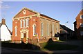
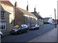
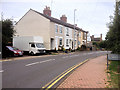
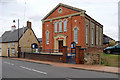
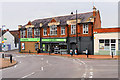
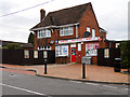
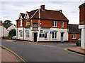
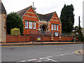
Photos of Irchester
Area Information
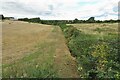
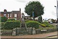
Irchester is a small built-up area covering just one square kilometre in England. Its compact size means daily life revolves close to home, offering convenience that larger towns cannot match. You will find a community where residents appreciate proximity to essential services without the congestion of a major city centre. Living in this neighbourhood provides a settled pace, ideal for those who value quiet streets and a sense of belonging. The area functions as a residential pocket within the wider Northamptonshire landscape, blending suburban comfort with local charm. Homes here offer a direct connection to nearby transport links and shopping options within a short commute. The character of Irchester is defined by its manageable scale and established residential nature. Prospective homebuyers should note that the environment is quieter than larger urban centres, making it attractive for retirees and families seeking stability. Every street balances privacy with accessibility to the surrounding region. This area represents a practical choice for people looking to secure a foothold in the Midlands without the high costs associated with bigger cities. The mix of housing suggests a long-standing community, rooted in stability and familiar local rhythms. You move here for the sense of place and the predictable, low-stress lifestyle that comes with such a defined locality.
- Area Type
- Built Up Area 250
- Area Size
- 1.0 km²
- Population
- Not available
- Population Density
- Not available
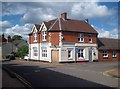
Daily life in Irchester revolves around a compact collection of practical amenities within easy reach. Retail options include a Co-op Irchester branch along with Spar and Budgens Rushden, covering most standard shopping requirements. These stores provide access to groceries, household essentials, and daily necessities without the need for extensive travel. The availability of multiple local outlets means you can compare prices and schedules conveniently between Tesco alternatives. Transport links are anchored by Wellingborough Railway Station, situated within practical reach for commuters. This rail connection offers access to wider travel networks, making regional travel a straightforward part of your routine. While there is only one listed rail facility, its presence connects you to broader hubs without being on-site in the immediate centre. The combination of local grocery stores and a nearby train station ensures that both day-to-day errands and longer commutes remain manageable. You can complete weekly shopping at the Co-op or Spar, then travel to other parts of the country via the railway. This blend of local independence and regional access defines the lifestyle here.
Amenities
Schools
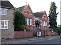
Families considering living in Irchester find a limited school estate directly serving the immediate neighbourhood. The closest educational provisions are Irchester Infant School and Irchester Junior School, both designated as primary institutions. These two schools form the core of local education, offering standard primary education within the walking distance of many homes. Irchester Community Primary School also operates within this vicinity, providing an additional option for primary-aged children. All three listed schools function solely as primary providers, meaning there is no secondary school option immediately within the area. Students typically progress to secondary education through arrangements with schools in larger towns like Wellingborough or Rushden, which serve the broader catchment zone. This setup implies that daily school runs involve travel for older children, while younger children benefit from local attendance at Infant or Junior departments. The presence of multiple primary options offers some flexibility for parents based on specific needs or location within the one-square-kilometre footprint. Families moving here should plan ahead for secondary education transitions, as those facilities lie outside the immediate vicinity of Irchester.
| Rank | School | Type | Entry gender | Ages |
|---|
Explore more schools in this area
Go to Schools tabDemographics
The community in Irchester displays a distinct demographic profile, primarily shaped by an older population. The median age stands at 70 years, indicating that the area attracts significant numbers of retirees who have moved from other parts of the country or remained after retirement. This age structure suggests a quiet, peaceful environment where families are less dominant than in younger neighbourhoods. The most common age range data confirms that the total population skews heavily towards this older bracket, influencing local demand for housing. Homeownership is the prevailing tenure type, with 76% of households owning their properties outright or with a mortgage. This high rate signals a stable community invested in their local homes rather than transient renters. The area is built for people who have established roots locally, leading to long-term residency and strong neighbourly ties. Accommodation types reflect this stability, with a majority of dwellings likely suited to single households or couples rather than large families. While specific figures on household composition by size are summarised under the total category, the ownership rate strongly implies a settled demographic. There is no data on ethnic diversity or religion breakdown in the current records, but the social fabric remains defined by this homogenous, owner-occupied demographic.
Household Size
Accommodation Type
Tenure
Ethnic Group
Religion
Household Composition
Age
Household Deprivation
NS-SEC
Explore more demographic insights in this area
Go to Demographics tabPlanning
Planning Constraints
- Crime RiskPremium