Area Overview for Ibstock West Ward
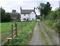
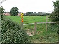
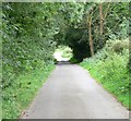
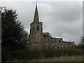
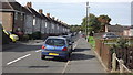
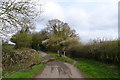
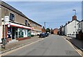
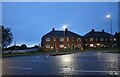
Photos of Ibstock West Ward


Area Information
Living in Ibstock West Ward offers a defined experience within the village of Ibstock. This electoral ward sits in the North West Leicestershire District Council area and covers a land mass of 2.1 square kilometres. Residents here enjoy a specific location in the East Midlands region of England, positioned at approximately 52.6826°N, 1.4089°W. The ward functions as a distinct unit within the parish, providing a focused community environment. Prospective buyers looking at homes in Ibstock find this area to be a compact settlement with clear boundaries. Daily life revolves around the practicalities of a small borough unitary ward where services and neighbours are relatively close. The geographic setting is straightforward, lacking the complexity of larger urban districts. You can navigate the area easily, knowing the physical limits are roughly two square kilometres. This compactness defines the rhythm of life here, offering a sense of proximity that larger towns sometimes lack. The area remains a significant part of the local administrative structure, balancing rural village life with municipal governance.
- Area Type
- District Borough Unitary Ward
- Area Size
- 2.1 km²
- Population
- Not available
- Population Density
- Not available
Demographics
Community life within Ibstock West Ward reflects a very specific demographic profile that influences daily interactions and service needs. The population has a median age of 70, which indicates an older resident base compared to the national average. This age distribution shapes the character of the neighbourhood, suggesting a community where retirement and later life stages are prominent. Home ownership stands at 54 per cent, meaning just over half of the households own their property outright or with a mortgage. The remaining households are rented, creating a split between ownership and tenancy. While ethnicity, religion, and specific household composition data are not detailed in the current records, the overall picture paints a settled demographic scene. The absence of specific diversity statistics suggests a relatively homogenous community, typical of many rural English wards. Understanding who lives here is essential for anyone considering schools near Ibstock West Ward or joining local groups. The high median age means amenities may cater to older adults, and the pace of life likely accommodates this majority. Buyers should consider how this age profile aligns with their own lifestyle expectations and family plans.
Household Size
Accommodation Type
Tenure
Ethnic Group
Religion
Household Composition
Age
Household Deprivation
NS-SEC
Explore more demographic insights in this area
Go to Demographics tabPlanning
Planning Constraints
- Flood RiskLocked
- Ramsar Wetland SitesLocked
- Area of Outstanding Natural BeautyLocked
- Protected Nature ReserveLocked
- Protected WoodlandLocked
- Crime RiskLocked