Area Overview for Hugglescote
Photos of Hugglescote


Area Information
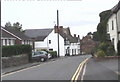
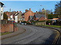
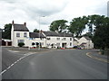
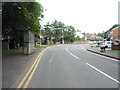
Living in Hugglescote means settling into a compact built-up area defined by its small scale and specific charm. This village covers just 1.4 km², creating a tight-knit environment where daily routines often unfold within short walking distances. The geography is straightforward, lacking sprawling industrial zones or complex urban layouts. Instead, the focus remains on residential calm and accessibility. You will find yourself surrounded by a community where the pace of life seems slower than in nearby larger towns. This physical footprint contributes to a distinct sense of place, separating Hugglescote from the broader Leicestershire countryside while maintaining strong rural connections. Prospective buyers looking for homes in Hugglescote should appreciate that the area lacks the overwhelming scale of a city centre. Daily life centres around local familiarities rather than distant commercial hubs. The area serves as a practical base for those who prefer quiet surroundings without complete isolation. You can enjoy the benefits of a recognised built-up area while avoiding the congestion of larger population centres. The character here is defined by its modest size and established residential nature.
- Area Type
- Built Up Area 250
- Area Size
- 1.4 km²
- Population
- Not available
- Population Density
- Not available
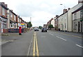
Living in Huggłaszcote offers a lifestyle centred on convenience rather than extensive entertainment options. Your daily needs are met by a clutch of five retail outlets within practical reach, providing essential shopping without the need for long car journeys. You will find specific stores such as Morrisons Daily, Co-op Oak, and Asda Ellistown providing groceries and everyday goods. These venues form the backbone of local commerce, allowing you to handle routine purchases with ease. For physical travel, Shackerstone Railway Station sits nearby as the main transport hub, giving you access to wider destinations when required. While the area does not boast a wide range of leisure facilities, dining options, or large parks within the immediate vicinity, the nearby retail cluster compensates for these gaps. The lifestyle here prioritises utility and simplicity over vibrant social scenes or diverse cultural activities. Shopping trips are quick and frequent, fitting seamlessly into a low-key daily routine. You trade the variety of a city centre for the peace of a village where essentials are just outside your door. This arrangement suits those who value a straightforward approach to daily living over bustling social environments.
Amenities
Schools
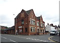
Families considering schools near Hugglescote have access to established local education provision within the village itself. The Hugglescote Community Primary School stands as the main educational facility serving the immediate area. It operates as a primary school and currently holds a Good rating from Ofsted, which is the national standard for judging school quality. This rating indicates that the school meets expected standards for education and care, providing a reliable option for families with younger children. While there is no secondary school listed in the immediate vicinity of Hugglescote in the provided data, the presence of this primary institution supports the residential needs of the village. You should plan ahead regarding transport or boarding if your children require secondary education beyond the primary level. The single primary school model means fewer choices within the village boundaries itself. However, the positive Ofsted rating offers reassurance regarding the standard of instruction your child would receive in their early years. This educational setup is a core component of family life for those residing in this locality.
| Rank | A + A* % | School | Type | Entry gender | Ages |
|---|---|---|---|---|---|
| 1 | N/A | Hugglescote Community Primary School | primary | N/A | N/A |
Explore more schools in this area
Go to Schools tabDemographics
The community in Hugglescote reflects a specific demographic profile shaped by long-term residence patterns. You will find that the median age for residents stands at 70 years, indicating a population skewed significantly towards older age groups. This age distribution suggests the area attracts retirees or long-standing families with children who have moved out. With 72% of homes occupied by owners, you are entering a market dominated by individuals who have invested in the locality over time. This high ownership rate typically correlates with a stability you might expect in a village where properties remain in the same families for generations. The household composition and accommodation types do not suggest a transient rental population but rather established occupants. While specific data on ethnic composition and religious affiliations is not detailed in available records, the overall picture points to a homogeneous community structure. The prevalence of owner-occupied homes often signals that residents have chosen this location for its enduring qualities rather than short-term gains. Understanding this age profile helps you recognise the nature of neighbourly interactions and local priorities within Hugglescote.
Household Size
Accommodation Type
Tenure
Ethnic Group
Religion
Household Composition
Age
Household Deprivation
NS-SEC
Explore more demographic insights in this area
Go to Demographics tabPlanning
Planning Constraints
- Crime RiskLocked