Area Overview for Hucknall South Ward
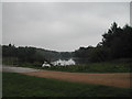
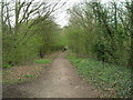
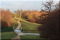
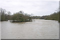
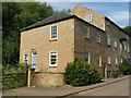
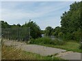
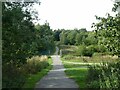
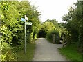
Photos of Hucknall South Ward
Area Information
Hucknall South Ward is a compact district sitting within the borough of Hucknall, covering just 2.6 square kilometres of land. This small geographical footprint creates a tightly knit environment where local amenities are often within walking distance. Living in Hucknall South Ward offers a settled pace of life, distinct from the commuter-heavy outskirts of larger cities. The area functions as a residential enclave where daily routines revolve around quiet neighbourhoods rather than commercial hubs. You will find a community that values stability, evidenced by the long-term residence of many families and individuals in the ward. The ward is characterised by its manageable size, which eliminates the vast feels often associated with larger metropolitan districts. Residents enjoy the benefits of a contained locality without the overwhelming scale of a major city centre. This specific area provides a therapeutic living experience suitable for those seeking simplicity in their daily commute and social interactions. The physical boundaries of this 2.6 km² zone define a clear sense of place. You can navigate the entirety of Hucknall South Ward with ease, knowing exactly what surrounds your immediate doorstep. This intimacy fosters a strong connection to the local geography, making it a practical choice for downsizers or families prioritising a manageable neighbourhood.
- Area Type
- District Borough Unitary Ward
- Area Size
- 2.6 km²
- Population
- Not available
- Population Density
- Not available
Demographics
The community profile of Hucknall South Ward reflects a mature population structure heavily skewed towards older residents. You will find that the median age across the area stands at 70 years, indicating a neighbourhood where life is often slower and community ties are woven over decades. This age demographic shapes the daily rhythm of the ward, with services catering to an older population. Home ownership plays a dominant role in this community dynamic, with 68% of residents owning their homes outright or with a mortgage. This high rate of ownership suggests that many people view this location as a permanent home rather than a temporary stepping stone. Understanding the household composition helps you gauge the daily life in this specific ward. While the area hosts a total population that creates a vibrant local scene, the primary driver remains the stability of established households. The accommodation types available suit this demographic, providing spaces that have been in the hands of previous generations. This high level of tenure means that any changes to the housing stock are likely to be gradual rather than through rapid developer turnover. When you consider the demographics of Hucknall South Ward, you are looking at a place where neighbours know each other by name. The stability provided by such a high ownership rate fosters a supportive environment. You can expect a low turnover of residents, which contributes to the quiet and peaceful atmosphere typical of this age profile.
Household Size
Accommodation Type
Tenure
Ethnic Group
Religion
Household Composition
Age
Household Deprivation
NS-SEC
Explore more demographic insights in this area
Go to Demographics tabPlanning
Planning Constraints
- Flood RiskPremium
- Ramsar Wetland SitesPremium
- Area of Outstanding Natural BeautyPremium
- Protected Nature ReservePremium
- Protected WoodlandPremium
- Crime RiskPremium