Area Overview for Holmewood & Heath Ward

Shortened Horizon in Holmewood & Heath Ward
Minor road towards Heath in Holmewood & Heath Ward
Shire Lane view towards Junction with Mansfield Road in Holmewood & Heath Ward
Williamthorpe Ponds Nature Reserve in Holmewood & Heath Ward
Making a new path in Grassmoor Country Park in Holmewood & Heath Ward
Path between the Williamthorpe Ponds in Holmewood & Heath Ward
North East Derbyshire : The A617 in Holmewood & Heath Ward
Yet more spray on the A617 in Holmewood & Heath Ward
Mansfield Road, from Slack Lane in Holmewood & Heath Ward
Lake, Williamthorpe Ponds Nature Reserve in Holmewood & Heath Ward
Gated field entrance in Holmewood & Heath Ward
Tracks in the Williamthorpe Ponds nature reserve in Holmewood & Heath Ward
17 photos from this area

Area Information

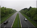
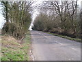
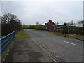
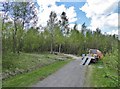
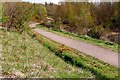
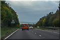
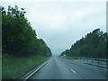
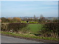
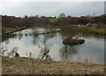
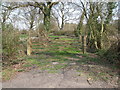
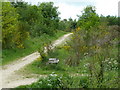
Living in Holmewood & Heath Ward offers a distinct character within the North East Derbyshire district of the East Midlands. This electoral ward covers an area of 10.5 km² and encompasses the parishes of Heath and Holmewood. It stands as a specific locality defined by its boundaries and local governance structure rather than a sprawling urban centre. You will find yourself in a setting where the physical space is relatively contained, allowing for a defined sense of place. The ward operates under the code E05012053, marking its official status within the larger administrative framework of Derbyshire. There is no AONB, Ramsar site, or protected nature reserve directly covering the main residential parts of the ward, which simplifies certain planning contexts for potential buyers. However, the presence of protected woodland within the boundary means发展新规划可能需要考虑生态因素. The area represents a specific slice of rural Derbyshire life where the landscape and administration align to create a cohesive whole. Understanding this geographical scope is the first step in evaluating a home in Holmewood & Heath Ward.

Area Type
District Borough Unitary Ward
Area Size
10.5 km²
Population
Not available
Population Density
Not available

Demographics

The community within Holmewood & Heath Ward reflects a clearly defined demographic profile centred on older age groups. The median age here is 70, indicating that the population is significantly older than the national average. While the specific most common age range is listed as "Total," the high median confirms that retirees and older residents make up the majority of those calling this place home. With 56% home ownership, you are more likely to find residents who have bought their properties than those renting from a landlord. This high self-ownership rate often correlates with the age profile, suggesting many residents have lived here for decades. The ward contains a mix of household compositions and accommodation types, though specific breakdowns for family size or housing tenure types are not detailed in the available summary. You should expect a neighbourhood where long-term residency is common. The population density across the 10.5 km² suggests a low-density living environment. When considering schools near Holmewood & Heath Ward, you must acknowledge that the immediate catchment is defined by this older population mix.

Household Size

total
most common

Accommodation Type

total
most common

Tenure

56
majority

Ethnic Group

total
most common

Religion

total
most common

Household Composition

total
most common

Age

70
median
Age: Total
most common

Household Deprivation

N/A
with no deprivation

NS-SEC

24
in Lower managerial occupations

Explore more demographic insights in this area

Go to Demographics tab

Planning

Planning Constraints

  • Flood Risk
    Premium
  • Ramsar Wetland Sites
    Premium
  • Area of Outstanding Natural Beauty
    Premium
  • Protected Nature Reserve
    Premium
  • Protected Woodland
    Premium
  • Crime Risk
    Premium

Explore more planning insights in this area

Open Planning map

Frequently Asked Questions

What is the demographic profile of Holmewood & Heath Ward?
The population in Holmewood & Heath Ward has a median age of 70, making it significantly older than the national average. This indicates the community is dominated by retirees and older residents. The ward covers 10.5 km² within North East Derbyshire. With 56% of residents homeownership levels being high, you are likely to find a stable community of long-term owners rather than a transient rental population.
How is the broadband connection in Holmewood & Heath Ward?
Digital connectivity in Holmewood & Heath Ward is excellent with a fixed broadband quality score of 98 out of 100. This is a top-tier rating meaning you can expect high-speed internet suitable for remote working or streaming. Residents do not face speed limitations due to the ward's rural location on the 10.5 km² area. This makes it a viable option for those reliant on robust digital infrastructure for daily life or work.
What are the safety risks in Holmewood & Heath Ward?
Safety assessments for Holmewood & Heath Ward show low flood risk but a medium crime risk. The flood risk score is 0.89, indicating it is safe from flooding. However, the crime risk score is 34 out of 100, which classifies the area as having medium crime rates around the national average. Residents are advised to use standard security precautions. There are no protected nature reserves or AONBs causing planning constraints, though protected woodland exists within the ward boundaries.
Where can I get to from Holmewood & Heath Ward?
The provided data does not contain specific details on bus routes, train stations, or road networks connecting Holmewood & Heath Ward to other towns. While the area has excellent fixed broadband for working from home, you must consult separate transport databases to check public transit connectivity. The ward itself covers 10.5 km² of North East Derbyshire land with no major planning constraints on internal movement.

We use cookies to provide you with the best experience. By continuing, you agree to our Cookie Policy .