Area Overview for Hodthorpe and Belph
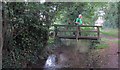
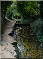
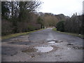
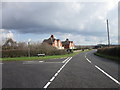
Photos of Hodthorpe and Belph
Area Information
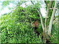
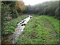
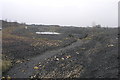
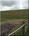
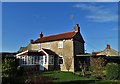
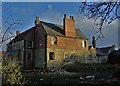
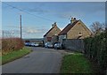
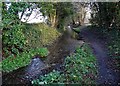
Hodthorpe and Belph is a civil parish located in the Bolsover district of Derbyshire, sitting on the edge of Sherwood Forest near the Nottinghamshire border. The parish covers an area of 5.3 km² and functions around two distinct settlements: the village of Hodthorpe and the historic hamlet of Belph. Belph dates back to at least 1086 as a dormitory to Whitwell and retains buildings from the 18th century under the stewardship of the Welbeck Estate. Hodthorpe, founded in 1804 to house miners from nearby collieries, developed an urban village feel with principal streets such as Queens Road and Kings Street. Daily life here blends suburban convenience with rural proximity to the forest edge and nearby Creswell Crags. The community is affectionately known as 'Happy Valley', reflecting its quiet character despite Hodthorpe's industrial roots evident in its history. Residents navigate a landscape that includes enclosed greens in Belph and three designated parks in Hodthorpe. This parish offers a specific type of Derbyshire living where historic heritage meets a settled, community-focused atmosphere. You will find the local shops and facilities concentrated within the village boundary, providing immediate access to daily necessities without venturing far from your home.
- Area Type
- Parish
- Area Size
- 5.3 km²
- Population
- Not available
- Population Density
- Not available
Demographics
The community profile of Hodthorpe and Belph reveals a population with a notably older demographic structure. The median age stands at 70 years, indicating that the area is primarily populated by older residents. The data categorises household composition and accommodation type under a general total, suggesting a stable residential makeup typical of retirement or long-term settled communities. You should expect a neighbourhood where life moves at a slower pace, shaped by an age profile that skews significantly towards the elderly. Home ownership is the dominant housing tenure in this parish, with 60% of properties owned outright or with a mortgage. This high rate of ownership suggests that residents view these homes as their long-term base rather than temporary rentals. The area reflects a settled population rather than a transient workforce. While specific figures on ethnic diversity, religion, and the breakdown of household types within the 'total' category are not itemised separately, the overarching data paints a picture of established occupancy. This demographic reality means you are moving into an area where neighbours are likely to have lived here for generations, creating a tight-knit social environment rather than a dynamic marketplace of young families and commuters.
Household Size
Accommodation Type
Tenure
Ethnic Group
Religion
Household Composition
Age
Household Deprivation
NS-SEC
Explore more demographic insights in this area
Go to Demographics tabPlanning
Planning Constraints
- Flood RiskPremium
- Ramsar Wetland SitesPremium
- Area of Outstanding Natural BeautyPremium
- Protected Nature ReservePremium
- Protected WoodlandPremium
- Crime RiskPremium