Area Overview for Hoby with Rotherby
Photos of Hoby with Rotherby
Area Information
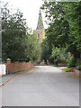
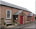
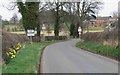
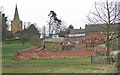
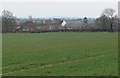
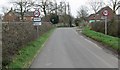
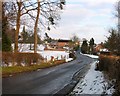
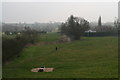
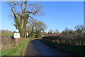
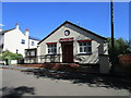
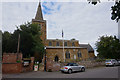
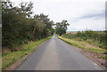
Living in Hoby with Rotherby offers a distinct rural experience within a civil parish covering 19.4 km². This community sits apart from the dense urban centres you might expect, providing a setting defined by its expansive local boundaries. The area represents a traditional English settlement where space and quiet character are primary features of daily life. You are buying into a location that prioritises calm over convenience, though modern digital infrastructure supports remote connectivity. The village structure suggests a close-knit environment where neighbours know one another, contrasting sharply with the anonymity of larger towns. Prospective buyers must recognise that this is a specific type of countryside living. The small landmass compared to nearby urban districts means amenities are likely located in close proximity to the main village core. Your daily routine will depend heavily on how well you adapt to this slower pace and limited transport options. The parish layout influences how you travel, walk, and interact with your surroundings. By choosing Hoby with Rotherby, you select an environment where the landscape dictates the rhythm of life rather than a strict commute schedule.
- Area Type
- Parish
- Area Size
- 19.4 km²
- Population
- Not available
- Population Density
- Not available
Demographics
The community profile of Hoby with Rotherby reveals a populace distinctly skewed towards older residents. The median age stands at 70, indicating that the majority of the population falls into the senior age bracket. This demographic reality shapes the local vibe, creating a neighbourhood dominated by retirees rather than families with young children or young professionals. Most common age data confirms that the youth population is minimal, meaning schools near Hoby with Rotherby may serve a limited catchment of local young people. Home ownership levels in this parish are exceptionally high, with 82% of households having outright ownership or a share of the equity. This statistic signals a quiet market dominated by long-term residents and older owners, rather than a transient renting population. You are unlikely to meet many new arrivals, as the high ownership figure suggests stability over short-term investment. The household composition aligns with this, featuring individuals living alone or with spouses, rather than young households raising children. Overall, the area feels mature and settled. With a median age of 70, the social events, pubs, and community groups cater primarily to an older demographic. If you are considering a move for retirement, the high ownership rate matches the age profile perfectly. However, if you require proximity to schools or services catering to young families, the demographic data suggests Hoby with Rotherby is not ideal. The community is stable but static, defined by those who have remained rather than those who have arrived.
Household Size
Accommodation Type
Tenure
Ethnic Group
Religion
Household Composition
Age
Household Deprivation
NS-SEC
Explore more demographic insights in this area
Go to Demographics tabPlanning
Planning Constraints
- Flood RiskPremium
- Ramsar Wetland SitesPremium
- Area of Outstanding Natural BeautyPremium
- Protected Nature ReservePremium
- Protected WoodlandPremium
- Crime RiskPremium