Area Overview for Highlane
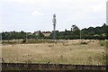
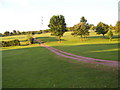
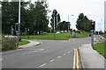
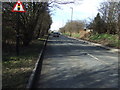
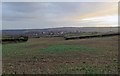
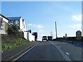
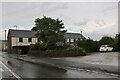
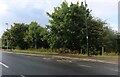
Photos of Highlane


Area Information
Highlane is a compact built-up area in England, covering 30 hectares and home to a community with a median age of 70. This suggests a population skewed toward older residents, many of whom may have long-standing ties to the area. The high home ownership rate of 82% indicates a stable, settled community, with most residents living in properties they own. Daily life in Highlane is shaped by its proximity to practical amenities, including retail outlets like Tesco Sheffield and railway stations such as Woodhouse and Dronfield, which provide easy access to nearby towns. The area’s modest size and established character make it a quiet, low-traffic place to live, with a focus on convenience over sprawling urban sprawl. For those seeking a retirement-friendly environment with reliable transport links and a mix of local shops, Highlane offers a straightforward, no-frills lifestyle. Its appeal lies in its simplicity, with a balance between accessibility and a slower pace of life.
- Area Type
- Built Up Area 250
- Area Size
- 30.0 hectares
- Population
- Not available
- Population Density
- Not available
Highlane’s residents have access to a range of nearby amenities, including retail outlets such as Co-op Petrol, Spar, and Tesco Sheffield, which provide essential shopping and fueling options. The area is also within practical reach of metro stops along Birley Moor Road, Birley Lane, and Hackenthorpe, offering easy access to public transport. Railway stations like Woodhouse, Darnall, and Dronfield further enhance connectivity, enabling travel to larger towns and cities. While the data does not specify parks or leisure facilities, the presence of these practical amenities suggests a focus on convenience and daily necessities. The mix of retail, transport, and local services creates a functional environment, ideal for those who value accessibility over expansive recreational spaces.
Amenities
Schools
The nearest school to Highlane is Ridgeway Primary School, which holds a ‘good’ Ofsted rating. This school serves the primary education needs of local children, offering a reliable option for families in the area. While no other schools are listed in the data, the presence of a primary school with a positive rating indicates that Highlane is positioned to support families with young children. The absence of secondary schools or additional educational institutions suggests that residents may need to travel to nearby towns for higher education. However, the quality of the existing primary school provides a solid foundation for young learners, ensuring that basic educational needs are met within the area.
| Rank | School | Type | Entry gender | Ages |
|---|
Explore more schools in this area
Go to Schools tabDemographics
Highlane’s population has a median age of 70, with the most common age range encompassing all demographics. This suggests a community that is predominantly older, which aligns with the 82% home ownership rate, a figure that implies long-term residency and financial stability. The data does not specify household composition or diversity, but the high home ownership percentage indicates a mature population with fewer transient residents. The accommodation types and ethnic groups are listed as totals, meaning no breakdown is available. However, the safety assessment, which rates the area as low risk with a score of 77, suggests that residents benefit from a stable, secure environment. For those prioritising a settled, older demographic with strong property ownership, Highlane’s profile is clear: it is a place where people stay for the long term, with minimal turnover and a focus on established living.
Household Size
Accommodation Type
Tenure
Ethnic Group
Religion
Household Composition
Age
Household Deprivation
NS-SEC
Explore more demographic insights in this area
Go to Demographics tabPlanning
Planning Constraints
- Crime RiskPremium