Area Overview for Helpringham & Osbournby Ward
Photos of Helpringham & Osbournby Ward

Area Information
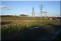
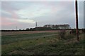
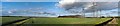
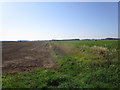
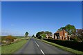
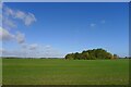
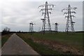
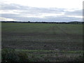
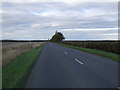
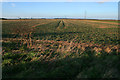
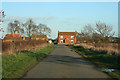
Helpringham & Osbournby Ward is an electoral ward located in the North Kesteven district of Lincolnshire, within the East Midlands region of England. This area spans a total size of 102.8 km² and encompasses the civil parishes of Helpringham and Osbournby, alongside other settlements like Aunsby and Dembleby. The ward sits near coordinates 52.9347°N, -0.3840°W, positioning it south of Sleaford. Historical records from the 19th century place Helpringham two and a half miles south of Heckington railway station and six miles south-east of Sleaford. The village was established on the Car Dyke navigation, a feature that remains a key geographical landmark for the built-up areas within the ward. Today, the settlement pattern consists of small village clusters rather than a single continuous town. Residents here experience a rural lifestyle defined by specific village communities rather than urban density. Living in Helpringham & Osbournby means your daily life revolves around these established parishes. You will find yourself surrounded by historic layouts and open spaces typical of the Lincolnshire landscape. The area offers a quiet environment away from major conurbations. Knowing the geography helps you understand your neighbours and the local rhythm of life in these specific civil parishes. Helpringham & Osbournby Ward represents a settled, agricultural character common to North Kesteven.
- Area Type
- District Borough Unitary Ward
- Area Size
- 102.8 km²
- Population
- Not available
- Population Density
- Not available
Demographics
The community profile within Helpringham & Osbournby Ward reveals a settlement dominated by older residents. The median age for the population stands at 70 years, indicating that the majority of households are occupied by older individuals. This age structure suggests the area caters primarily to retirees or those with established family ties. Regarding how you acquire your home, 69% of properties are owner-occupied. This high ownership rate demonstrates that the market is driven by long-term residents who have purchased their homes rather than renting. The remaining 31% of housing represents rented accommodation, though specific data on social versus private renting is not detailed in the available figures. Household composition and predominant ethnic group data are classified as total, providing no breakdown of specific categories. Religion data is also classified as total, offering no insight into specific denominational make-up. The average household size or specific family type breakdowns are not explicitly detailed in the census summary. This profile paints a picture of a stable, settled community where ownership is the norm. You will likely find a neighbourhood where residents stay for the long term rather than transient populations. The demographic reality focuses on an older population with significant home equity.
Household Size
Accommodation Type
Tenure
Ethnic Group
Religion
Household Composition
Age
Household Deprivation
NS-SEC
Explore more demographic insights in this area
Go to Demographics tabPlanning
Planning Constraints
- Flood RiskPremium
- Ramsar Wetland SitesPremium
- Area of Outstanding Natural BeautyPremium
- Protected Nature ReservePremium
- Protected WoodlandPremium
- Crime RiskPremium