Area Overview for Heighington & Washingborough Ward
Photos of Heighington & Washingborough Ward
Area Information
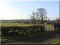
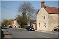
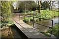
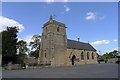
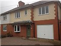
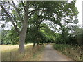
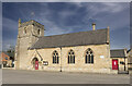
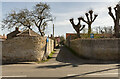
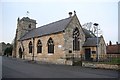
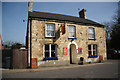
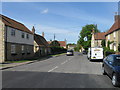
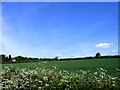
Living in Heighington & Washingborough Ward offers a distinct residential experience defined by its rural location within North Kesteven, Lincolnshire. This electoral ward encompasses the civil parishes of Heighington and Washingborough, covering a total area of 27.3 square kilometres. With a population of 3,447 people, the community maintains a low density of 126 people per square kilometre, ensuring a tranquil environment for those seeking to escape the rush of city life. Heighington village sits approximately four miles south-east of Lincoln, bordering Washingborough along established routes like Sheepwash Lane. The landscape holds deep historical significance, featuring a Grade II listed chapel from the 12th century that was restored in the early 17th century by fen-adventurer Thomas Garratt. Daily life revolves around local amenities such as the Butcher and Beast and Turks Head public houses on High Street, alongside Heighington Millfield Primary Academy. The area is not entirely isolated from broader connectivity, as the Peterborough to Lincoln Line passes just to the west, even though the area's railway stations closed decades ago. Residents here navigate a space where historical charm meets modern living needs, situated close enough to Lincoln for occasional trips yet far enough to enjoy the quiet of the East Midlands. The ward stands as a quiet pocket of England, characterised by its agricultural roots and established village centres.
- Area Type
- District Borough Unitary Ward
- Area Size
- 27.3 km²
- Population
- 3447
- Population Density
- 126 people/km²
Demographics
The community within Heighington & Washingborough Ward presents a clear demographic profile dominated by older residents. The median age stands at 70, indicating that the majority of the local population comprises seniors. This age structure contrasts sharply with areas typically filled with young families or students. Home ownership is exceptionally high, with 81% of residents owning their property outright or with a mortgage. This figure suggests a stable community where long-term residency is common, rather than a transient rental market. While specific breakdowns for household composition, predominant ethnic groups, and religious affiliations are not detailed in the available data, the high ownership percentage points towards a settled population. The low population density of 126 people per square kilometre further reinforces the quiet, non-urban nature of daily life. There are no indications of rapid demographic shifts or significant influxes of new residents, which contributes to a consistent community feel. For anyone considering homes in this ward, the demographic reality is one of an older, homeownership-centric population where traditions and established routines likely hold significant sway over local culture.
Household Size
Accommodation Type
Tenure
Ethnic Group
Religion
Household Composition
Age
Household Deprivation
NS-SEC
Explore more demographic insights in this area
Go to Demographics tabPlanning
Planning Constraints
- Flood RiskPremium
- Ramsar Wetland SitesPremium
- Area of Outstanding Natural BeautyPremium
- Protected Nature ReservePremium
- Protected WoodlandPremium
- Crime RiskPremium