Area Overview for Hasland Ward
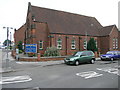
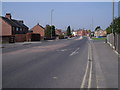
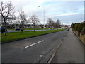
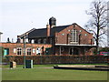
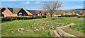
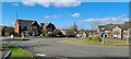
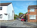
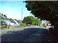
Photos of Hasland Ward
Area Information
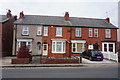
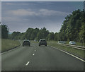
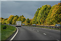
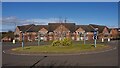
Living in Hasland Ward offers a defined suburban experience within the Borough of Chesterfield. You are entering a district that occupies just 2.3 km², yet it houses a resident population of 1,388 people. This compact size creates a close-knit environment where the electorate division sits south of Spital, east of Birdholme, and north of Grassmoor. The area has deep historical roots as an electoral division, but modern development mainly occurred from the late 19th century onwards. The contemporary suburb grew from an older hamlet located at a road junction branching towards North Wingfield from the historic Chesterfield-to-Mansfield main road. Historical records confirm that the original township contained several distinct settlements. Today, the landscape features the church of SS Augustine, which sits alongside local authority housing estates built in the 1920s. The area remains one of twelve townships that comprised the ancient parish of Chesterfield. You will find that geography here is unique compared to other areas in the borough, with land lying on both sides of the river Rother. This specific layout defines the boundary conditions for your daily movement through the ward. The suburb avoids complex planning constraints related to protected natural sites. Your location places you in a stable residential zone with clear historical significance and defined physical limits.
- Area Type
- District Borough Unitary Ward
- Area Size
- 2.3 km²
- Population
- 1388
- Population Density
- 610 people/km²
Demographics
The community profile of Hasland Ward reveals an older demographic structure. You will find that the median age stands at 70, indicating a significant portion of residents are seniors rather than young families. This age profile suggests a quarter-life neighbourhood where many people have lived in the same homes for decades. Home ownership is high, with figures showing that 73% of households own their property outright. This contrasts sharply with areas dominated by uncertain tenancy arrangements. The remaining 27% likely comprise long-term tenants or those renting from family members. There are no specific data points provided regarding religious affiliation or predominant ethnic groups within the dataset. You must rely on the confirmed statistics regarding age and tenure to understand the social fabric. The household composition data available is limited to general totals, preventing a detailed breakdown of single-person versus multi-generational living. However, the high ownership rate points toward stability. Residents here are invested in their local environment. You do not need to worry about rapid population displacement or low-cost housing influxes altering the character of the streets. The age distribution means services and social activities often cater to mature preferences.
Household Size
Accommodation Type
Tenure
Ethnic Group
Religion
Household Composition
Age
Household Deprivation
NS-SEC
Explore more demographic insights in this area
Go to Demographics tabPlanning
Planning Constraints
- Flood RiskPremium
- Ramsar Wetland SitesPremium
- Area of Outstanding Natural BeautyPremium
- Protected Nature ReservePremium
- Protected WoodlandPremium
- Crime RiskPremium