Area Overview for Hartshorne
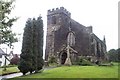
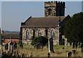
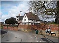
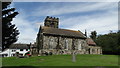
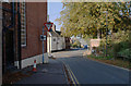
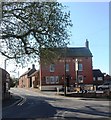
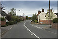
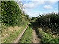
Photos of Hartshorne

Area Information
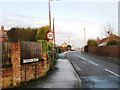
Hartshorne is a compact built-up area spanning 50.9 hectares, offering a quiet, low-density living environment in England. With a median age of 70, the community here is predominantly older, suggesting a mature, stable population. The area’s safety is a notable feature, with a crime risk score of 71 — a pass — indicating below-average crime rates and a secure environment for residents. For those prioritising connectivity, Hartshorne benefits from excellent broadband quality, scoring 97 out of 100, and strong mobile coverage at 84. This makes it suitable for remote work or reliable daily internet use. Nearby, residents have access to essential retail outlets such as Sainsburys in Swadlincote and Tesco in Woodville, along with two railway stations — Willington and Burton — providing practical links to surrounding areas. The presence of Hartshorne CofE Primary School, rated good by Ofsted, adds to the area’s appeal for families. While the population is small, the mix of amenities and low crime risk positions Hartshorne as a viable option for those seeking a peaceful, well-connected community.
- Area Type
- Built Up Area 250
- Area Size
- 50.9 hectares
- Population
- Not available
- Population Density
- Not available
Hartshorne’s proximity to retail hubs like Sainsburys in Swadlincote, Asda in Woodville Burton, and Tesco in Woodville provides residents with convenient access to essential shopping. These stores offer a range of goods, from groceries to household items, supporting daily living needs. The area’s railway stations — Willington and Burton — add to its practicality, enabling easy travel for work, leisure, or socialising. While the data does not mention parks or leisure facilities, the presence of retail and transport options suggests a functional lifestyle. The combination of nearby shops and rail links means residents can manage errands and travel efficiently, contributing to a low-maintenance, accessible way of life. The absence of specific details on green spaces or recreational areas, however, leaves room for further exploration of the area’s leisure offerings.
Amenities
Schools
The nearest school to Hartshorne is Hartshorne CofE Primary School, which serves the local community with a primary education offering. The school holds a good Ofsted rating, reflecting satisfactory standards in teaching, pupil outcomes, and overall performance. As a primary school, it caters to younger children, making it a key consideration for families with young dependents. The data does not include secondary schools or other educational institutions in the area, so the full range of schooling options is not clear. However, the presence of a well-rated primary school suggests that families may find the area suitable for early education needs. The absence of additional schools, though, means that prospective residents should investigate further if secondary education is a priority.
| Rank | School | Type | Entry gender | Ages |
|---|
Explore more schools in this area
Go to Schools tabDemographics
The population of Hartshorne reflects a median age of 70, the highest in the dataset, suggesting a community composed largely of older residents. Home ownership stands at 64%, indicating a significant portion of the housing stock is owner-occupied. However, the data does not specify household composition or accommodation types, so it is unclear whether the area is dominated by single-person households, couples, or families. The predominant ethnic group and religious affiliation are listed as total, meaning no specific breakdown is available. This lack of detail means the area’s diversity or cultural dynamics cannot be assessed from the data provided. The absence of deprivation statistics also limits insight into the quality of life for residents. While the age profile hints at a settled, mature population, further information would be needed to fully understand the community’s structure or needs.
Household Size
Accommodation Type
Tenure
Ethnic Group
Religion
Household Composition
Age
Household Deprivation
NS-SEC
Explore more demographic insights in this area
Go to Demographics tabPlanning
Planning Constraints
- Crime RiskPremium