Area Overview for Hartington & Taddington Ward
Photos of Hartington & Taddington Ward
Area Information
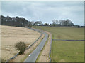
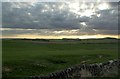
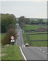
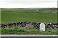
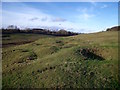
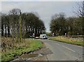
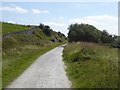
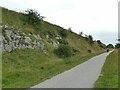
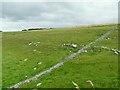
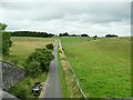
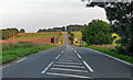
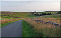
Hartington & Taddington Ward covers a substantial 83.8 square kilometres, offering a sprawling landscape distinct from more densely populated suburban districts. This ward is situated in Derbyshire, England, providing a setting defined by its open space and rural character rather than immediate proximity to a city centre. Living in Hartington & Taddington Ward means embracing a lifestyle where the structures on your front doorstep reflect a community maturing well into its later years. The area contains significant protected woodland and nature reserves, which shape the physical environment and constrain development plans for the future. You will find yourself in a borough unitary ward where daily life is paced by the rhythm of nature rather than traffic congestion. The sheer size of the ward suggests a low density of infrastructure, and you should expect distances between services to be greater than you might in a smaller urban ward. This makes the location particularly suitable for those who prioritise space and quiet over rapid access to metropolitan hubs. The absence of Ramsar wetland sites or areas of outstanding natural beauty within the ward boundaries indicates that while nature is present, it is not irreplaceable in the strictest conservation terms. For anyone considering homes in Hartington & Taddington Ward, the primary reality is a vast, semi-rural expanse where the pace of life is measured in seasons rather than rush hour.
- Area Type
- District Borough Unitary Ward
- Area Size
- 83.8 km²
- Population
- Not available
- Population Density
- Not available
Demographics
The community within Hartington & Taddington Ward is defined by an exceptionally senior population. The median age stands at 70, which means half of all residents are older than this figure and the other half are younger. When analysing the data provided, the most common age range is recorded as 'Age: Total', reflecting the broad but older skew of the demographic profile. This contrasts sharply with student towns or commuter belts, suggesting that Hartington & Taddington Ward serves as a retirement or established family location rather than a young professional hub. Most residents have remained in the area for a considerable time, with 79% of households owning their homes outright or with a mortgage. This high level of home ownership signifies stability within the local community. Very few people are renting, which often translates into long-term residency and established local bonds. The ward does not display data regarding specific household composition breakdowns, predominant ethnic groups, or religious affiliations in the provided metrics. However, the sheer size of the owner-occupied sector implies a settled population that is unlikely to move frequently. If you are looking to live in Hartington & Taddington Ward, you will join a neighbourhood where the demographics lean heavily towards older generations who have put down roots. The lack of rental data further reinforces the picture of a self-contained community where most people are homeowners planning to stay for the long haul.
Household Size
Accommodation Type
Tenure
Ethnic Group
Religion
Household Composition
Age
Household Deprivation
NS-SEC
Explore more demographic insights in this area
Go to Demographics tabPlanning
Planning Constraints
- Flood RiskPremium
- Ramsar Wetland SitesPremium
- Area of Outstanding Natural BeautyPremium
- Protected Nature ReservePremium
- Protected WoodlandPremium
- Crime RiskPremium