Area Overview for Harmston
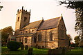
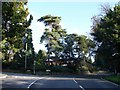
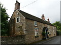
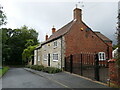
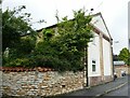
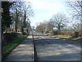
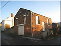
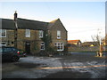
Photos of Harmston


Area Information
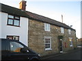
Harmston is a compact built-up area spanning 30.5 hectares, nestled in England. Its small size means the community feels close-knit, with daily life shaped by proximity to key services and transport links. The area’s median age of 70 suggests a predominantly older population, which influences the local character and pace of life. Residents benefit from practical access to nearby amenities, including RAF Waddington, two railway stations, and a range of retail outlets. While the area lacks the density of larger towns, its manageable scale offers a quiet, low-stress environment. For those prioritising safety, Harmston scores highly, with a crime risk rating of 92, indicating a secure place to live. The combination of practical infrastructure, low crime, and accessible transport makes it a viable option for those seeking a settled, community-oriented lifestyle.
- Area Type
- Built Up Area 250
- Area Size
- 30.5 hectares
- Population
- Not available
- Population Density
- Not available
Residents of Harmston have access to a range of nearby amenities, including five retail outlets such as Budgens Waddington, Spar, and the Lincolnshire Co-operative. These shops provide everyday essentials, ensuring convenience for local needs. The proximity to RAF Waddington and two railway stations enhances mobility, connecting the area to broader regional networks. While the data does not mention parks or leisure facilities, the presence of retail and transport options suggests a functional lifestyle focused on practicality. The compact nature of the area means amenities are within walking or short driving distance, supporting a low-effort, community-oriented way of life. For those valuing accessibility over extensive leisure options, Harmston offers a straightforward, service-oriented environment.
Amenities
Schools
| Rank | A + A* % | School | Type | Entry gender | Ages |
|---|
Explore more schools in this area
Go to Schools tabDemographics
Harmston’s population is defined by its median age of 70, reflecting a community skewed towards older adults. The most common age range is listed as “Total,” suggesting a broad demographic spread but with a notable emphasis on senior residents. Home ownership is high, with 83% of households owning their properties, indicating a stable, long-term resident base. While the data does not specify household composition or ethnic diversity, the figures suggest a mature population with established living patterns. The absence of detailed breakdowns on accommodation types or cultural diversity means the area’s social fabric remains partially opaque, but the high ownership rate points to a community prioritising permanence over transience.
Household Size
Accommodation Type
Tenure
Ethnic Group
Religion
Household Composition
Age
Household Deprivation
NS-SEC
Explore more demographic insights in this area
Go to Demographics tabPlanning
Planning Constraints
- Crime RiskLocked