Area Overview for Hardingstone
Photos of Hardingstone


Area Information
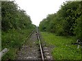
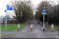
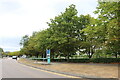
Hardingstone is a civil parish situated on the southern edge of Northampton in the East Midlands. The area covers a specific landmass of 5.0 km², positioning it as a close neighbour to the expanding urban centre rather than an isolated rural settlement. You will find the village separated from Wootton by the B526 road, which helped shape its current layout as a suburb with a distinct character. Despite its proximity to a major town, the parish retains historical depth, having been first mentioned in the Domesday Book. Archaeological remains from Iron Age and Roman periods exist on the ridge above the Nene valley, highlighting a settlement history that dates back centuries. Living in Hardingstone means accessing local conveniences while remaining near significant landmarks such as Delapré Abbey. The community includes two pubs, The Crown and The Sun, along with a post office and a corner shop. These facilities support everyday needs without requiring long daily commutes into the city centre itself. The presence of the Brackmills Industrial Estate nearby indicates a pragmatic mix of residential and commercial zones within the local boundary. You can encounter local history at the 12th-century parish church of St Edmund, which features 14th-century arcades and serves as a focal point for the neighbourhood. The area also has several listed buildings, including the original school building from 1860 to 1870, which now functions as a village hall. This blend of historic architecture and modern suburban life defines the practical reality for households in the parish.
- Area Type
- Parish
- Area Size
- 5.0 km²
- Population
- Not available
- Population Density
- Not available
Demographics
The community within Hardingstone is defined by a stable demographic profile with a median age of 70. This figure indicates an older population compared to the national average, reflecting the area's status as a long-established residential zone. While the most common age range data lists the total population, the high median age suggests that families with young children may be a minority compared to older residents. Currently, 75% of households in Hardingstone are owner-occupied, showing a strong preference for home ownership over renting. This high rate of ownership often correlates with higher life stages where residents have secured their property and remain put for the long term. The household composition data covers the total number of households, confirming that the village accommodates around 885 units according to 2021 census figures used in the area's research. Accommodation type statistics also reflect the total count of dwellings, suggesting a consistent stock rather than a mix of social and private housing. The predominant ethnic group and religious affiliation data represent totals across the parish, painting a picture of a traditionally homogenous community typical of many English parish towns. You will find that the area does not typically feature the rapid demographic shifts seen in younger suburbs. Instead, the population remains steady, supported by the existing local amenities and historical continuity of the village.
Household Size
Accommodation Type
Tenure
Ethnic Group
Religion
Household Composition
Age
Household Deprivation
NS-SEC
Explore more demographic insights in this area
Go to Demographics tabPlanning
Planning Constraints
- Flood RiskPremium
- Ramsar Wetland SitesPremium
- Area of Outstanding Natural BeautyPremium
- Protected Nature ReservePremium
- Protected WoodlandPremium
- Crime RiskPremium