Area Overview for Hamilton Lea
Photos of Hamilton Lea


Area Information
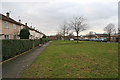
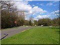
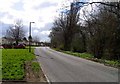
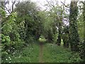
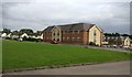
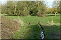
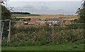
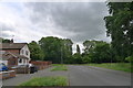
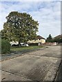
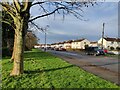
Hamilton Lea represents a unique living environment for those seeking a quiet village life on the edge of Leicester. This civil parish holds the smallest inhabited area in the United Kingdom at 9.689 km², creating a compact community that stretches along Catteric Way, northern Laverton Road, and Hackness Road. The landscape is defined by its recent development history, transforming what was once part of the longer-established Barkby Thorpe parish into a modern residential settlement. You will find yourself living in a space that revives the name of a deserted medieval village, situated just a short distance from the city boundaries. The area spans 18.5 hectares in its current administrative form, blending modern housing with the legacy of a site abandoned in the mid-15th century. A public footpath connects residents to the historic remnants of Hamilton, including moated sites and holloways, offering local history within walking distance. Daily life here is characterised by proximity to infrastructure rather than deep rural isolation, perfect for commuters who value access to roads like Hamilton Lane and seek a low-density setting. The parish currently holds annual meetings instead of a formal council, reflecting its compact nature and recent formation in April 2019. Living in Hamilton Lea means choosing a specific slice of Charnwood borough where new developments meet historical ground, providing a distinct alternative to the more established suburbs of Leicester.
- Area Type
- Parish
- Area Size
- 18.5 hectares
- Population
- Not available
- Population Density
- Not available
Demographics
The community profile of Hamilton Lea reveals a settlement dominated by older residents. Data indicates that the median age for the population is 70 years, suggesting a neighbourhood where the most common age groups skew significantly towards retirees or older adults. This demographic shift influences the daily rhythm of the parish, which revolves around the needs of a mature household composition rather than young families or students. You are likely to encounter a stable population taking advantage of established pension incomes and long-term residency benefits. Home ownership stands at 8,000 households, with the majority of accommodation types occupied by individual owners rather than tenants. A full 78% of residents own their homes outright, creating a financial environment where many locals have significant asset value and stability. While specific figures on ethnic diversity and religious breakdown are not referenced in the available documentation, the high ownership rate often points to areas where people have stayed for decades. This tenure model means you are entering a market where neighbours have been established long before the recent housing expansion occurred around 2019. The low density across the 9.689 km² further reinforces a tranquil existence where community interactions are likely close-knit and centred on shared interests rather than transient workforce dynamics.
Household Size
Accommodation Type
Tenure
Ethnic Group
Religion
Household Composition
Age
Household Deprivation
NS-SEC
Explore more demographic insights in this area
Go to Demographics tabPlanning
Planning Constraints
- Flood RiskPremium
- Ramsar Wetland SitesPremium
- Area of Outstanding Natural BeautyPremium
- Protected Nature ReservePremium
- Protected WoodlandPremium
- Crime RiskPremium