Area Overview for Hallington
Photos of Hallington
Area Information
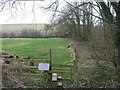
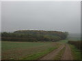
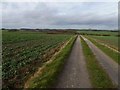
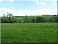
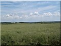
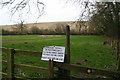
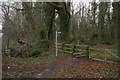
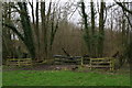
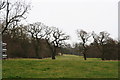
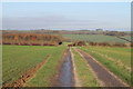
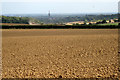
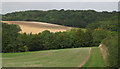
Living in Hallington offers a distinctly rural experience within a civil parish covering 5.9 square kilometres. This secluded location prioritises quiet over convenience, appealing to those seeking escape from busy urban centres rather than daily access to city life. The area functions as a self-contained community where residents rely heavily on local infrastructure and transport links outside the parish boundaries. You will find a landscape defined by open spaces rather than dense development, characteristic of the parish's rural designation. The distinctive character of Hallington stems from its isolation and low-density housing stock. Daily life here revolves around the local village core, with further amenities requiring travel. This geographical reality shapes the lifestyle, favouring homeowners who value peace over proximity to major employment hubs. The area does not cater to commuters looking for rapid links to metropolitan centres; instead, it suits those content with a slower pace. Neighbours know one another well, fostering a strong sense of locality that spreads across the entire five square kilometres. The environment is calm, with limited footfall on main roads except when connecting to wider regional networks. This setting creates a specific rhythm to living here, one that requires planning for longer journeys but rewards those with patience.
- Area Type
- Parish
- Area Size
- 5.9 km²
- Population
- Not available
- Population Density
- Not available
Demographics
The community in Hallington presents a clear demographic picture centred on older residents and established homeownership. Your potential neighbours are likely to be in their seventies or older, reflecting a median age of 70 years across the parish. This age profile suggests a population enjoying retirement or approaching it, rather than a hub for young families or university students. Most households in Hallington fit this older demographic mould, creating an environment where social interactions often centre on established family units. Home ownership stands at an impressive 70%, indicating that the majority of people here live in their own properties rather than renting. This high rate of ownership stabilises the community, as residents tend to stay put for longer periods. Accommodation types generally align with this ownership figure, resulting in a stock dominated by detached or semi-detached houses suitable for larger families or the elderly. The population lacks significant diversity in terms of age or household composition, creating a very homogenous social environment. Deprivation indices are not highlighted in the available data, but the high ownership rate and older age profile generally correlate with more stable economic conditions within the local estate.
Household Size
Accommodation Type
Tenure
Ethnic Group
Religion
Household Composition
Age
Household Deprivation
NS-SEC
Explore more demographic insights in this area
Go to Demographics tabPlanning
Planning Constraints
- Flood RiskPremium
- Ramsar Wetland SitesPremium
- Area of Outstanding Natural BeautyPremium
- Protected Nature ReservePremium
- Protected WoodlandPremium
- Crime RiskPremium