Area Overview for Hadfield South Ward
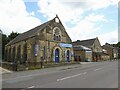
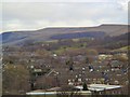
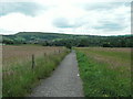
Photos of Hadfield South Ward

Area Information
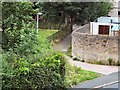
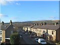
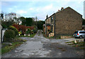
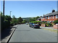
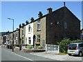
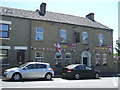
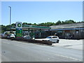
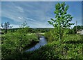
Living in Hadfield South Ward means residing in a defined electoral ward within the High Peak Borough of Derbyshire, positioned at the western edge of the Peak District near the Greater Manchester border. This district covers a compact 1.7 km² and forms the southern portion of the larger town of Hadfield. You will find the area situated on the south side of the River Etherow, deep within the scenic Longdendale valley. The location places you just a short distance from the neighbouring market town of Glossop, offering easy access to wider regional centres while maintaining a distinct local identity. Coordinates sit approximately at 53.46°N 1.97°W, near the Hadfield town centre, anchoring this ward firmly in the geography of the East Midlands region. This specific boundary, recognised officially as E05010634, captures a slice of life defined by its proximity to natural landscapes and its integration into the functional economy of greater Manchester and Derbyshire.
- Area Type
- District Borough Unitary Ward
- Area Size
- 1.7 km²
- Population
- Not available
- Population Density
- Not available
Demographics
The community profile in Hadfield South Ward reflects a mature population, with a median age of 70 years. This significant age demographic suggests a neighbourhood where retirement living is a common reality. The household composition data indicates a wide spread across all age categories, reinforcing the presence of older residents throughout the area. Home ownership is the dominant tenancy model, with 78% of residents owning their properties outright. This high level of ownership points towards a stable community where families have likely settled for the long term rather than cycling frequently through rentals. While specific details on ethnic diversity and religious affiliation are not detailed in the current statistics, the established nature of the housing stock implies a traditional demographic structure typical of historic valleys in northern England. Residents here are accustomed to a slower pace of life, aligning with the advanced age profile of the majority.
Household Size
Accommodation Type
Tenure
Ethnic Group
Religion
Household Composition
Age
Household Deprivation
NS-SEC
Explore more demographic insights in this area
Go to Demographics tabPlanning
Planning Constraints
- Flood RiskPremium
- Ramsar Wetland SitesPremium
- Area of Outstanding Natural BeautyPremium
- Protected Nature ReservePremium
- Protected WoodlandPremium
- Crime RiskPremium