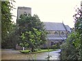
Area Overview for Hadfield North Ward
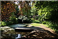
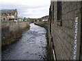
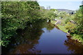
Photos of Hadfield North Ward
Area Information
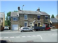
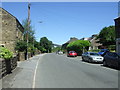
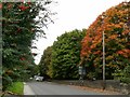
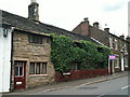
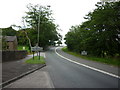
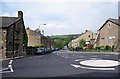
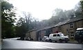
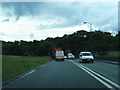
Hadfield North Ward sits as the northern extension of Hadfield within the High Peak borough of Derbyshire. This electoral ward covers 69.8 hectares and hosts a population of 1,760 people. It lies on the south side of the River Etherow, placing it close to the Greater Manchester border and the western edge of the Peak District. The location is immediately accessible to the town of Glossop, creating a defined residential zone where community life revolves around local connectivity and proximity to the wider region. You will find yourself in a district that balances its position as a northern boundary ward with practical links to key services nearby. The specific coordinates of 53.46°N 1.97°W place the area firmly within the East Midlands region, yet its proximity to Manchester influences its character. Living in Hadfield North Ward means residing in a compact area where the landscape is dominated by the immediate surroundings of a residential settlement. You do not live within a town centre or a sprawling countryside; you inhabit a specific ward defined by administrative boundaries and its relationship to the main town and the river. The neighbourhood supports its 1,760 residents through the practical infrastructure required for daily living in this established part of the High Peak borough.
- Area Type
- District Borough Unitary Ward
- Area Size
- 69.8 hectares
- Population
- Not available
- Population Density
- Not available
Demographics
The community within this ward is distinctly older than the national average, with a median age of 70 years. This demographic profile suggests a retirement settlement or a location favoured by those who have retired from work in larger cities. You will find that the most common age range spans the total population under the current categorisation, though the high median age indicates a shift away from families with young children. Home ownership stands at 57%, meaning just over half of households own their property outright or with a mortgage while the remainder likely rent. This ownership rate is typical for similar age structures where residents either downsize or purchase substantial properties. The ward contains a total household composition that reflects an aging population rather than a mixed workforce economy. Diversity data indicates a total predominant ethnic group without specific breakdown percentages provided for the ward itself. Consequently, the community feels homogeneous and settled, catering primarily to the needs of older residents. You should expect a quiet environment where shopping trips are often necessities rather than daily leisure activities driven by young families seeking new schools or playgrounds nearby. The accommodation type data listed as total confirms that the housing stock is built to support this single demographic profile rather than a younger, mobile workforce.
Household Size
Accommodation Type
Tenure
Ethnic Group
Religion
Household Composition
Age
Household Deprivation
NS-SEC
Explore more demographic insights in this area
Go to Demographics tabPlanning
Planning Constraints
- Flood RiskPremium
- Ramsar Wetland SitesPremium
- Area of Outstanding Natural BeautyPremium
- Protected Nature ReservePremium
- Protected WoodlandPremium
- Crime RiskPremium