Area Overview for Gunthorpe
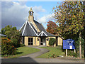
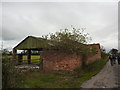
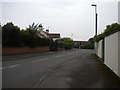
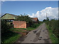
Photos of Gunthorpe
Area Information
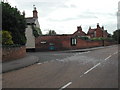
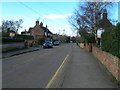
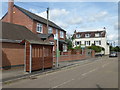
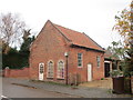
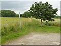
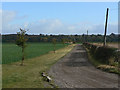
Gunthorpe is a built-up area situated on the left bank of the River Trent within the Newark and Sherwood district of Nottinghamshire. At the 2021 census, the population stood at 740 across a total area size of 33.3 hectares. This community exists as a village and civil parish, historically noted as a township within Lowdham parish located nine miles east-north-east of Nottingham. The name Gunthorpe derives from Old Norse origins, reflecting its Viking-era history as an outlying settlement. Today, the area functions as a distinct residential pocket rather than a standalone town with commercial density. You will find yourself living in a sheltered environment defined by the river and its historic bridge. The first Gunthorpe Bridge opened in 1875, replacing an older ferry that historically connected the locality to Bingham. Gunthorpe Lock remains a notable feature suitable for picnics, anchoring the local landscape. Because the area is compact, daily life revolves around immediate surroundings and connections to nearby villages. The sense of place is rooted in this long history, dating back to the establishment of a chapel of ease in 1850 and a Wesleyan chapel mentioned during the 1870s. When you consider living in Gunthorpe, you are choosing a spot with deep historical roots and a clear link to the Trent Valley's transport heritage.
- Area Type
- Built Up Area 250
- Area Size
- 33.3 hectares
- Population
- Not available
- Population Density
- Not available
Residents of Gunthorpe enjoy a convenient network of amenities located within practical reach, despite the village's rural setting. The nearest retail opportunities include Spar, Co-op Lowdham, and Budgens Gonalston, ensuring access to fresh food and essentials without needing to travel far. There are five notable railway stations serving the area, including Lowdham, Burton Joyce, and Bingham, which facilitate travel to larger urban centres. One airport, Nottingham Airport, is also listed as a nearby amenity, offering regional flight connections. Gunthorpe Lock on the River Trent serves as a local leisure spot suitable for picnics, adding a layer of natural enjoyment to daily life. The area's character is shaped by these specific, named facilities rather than abstract concepts of lifestyle. When considering living in Gunthorpe, you are choosing a quiet lifestyle where five shops and several train stations are within manageable distance. The presence of Co-op Lowdham and Budgens Gonalston indicates that daily necessities are available close by. This mix of high-street retail and transport hubs supports a self-contained existence for those who do not wish to drive frequently.
Amenities
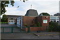
Schools
The only schools listed within the immediate neighbourhood data for Gunthorpe are two entries for Gunthorpe CofE Primary School, identified as primary institutions. This limited selection confirms that the immediate vicinity contains only primary education facilities. Families living in Gunthorpe with children aged eight and over will need to look beyond the immediate parish for secondary education options. The presence of a Church of England primary school indicates a community with established religious ties and traditional educational foundations. Since the data does not provide Ofsted ratings for this institution, you cannot verify the specific quality metrics without visiting the school directly. The name Gunthorpe CofE Primary School appears twice in the available records, reinforcing its status as the sole local educational provider. For those moving homes in Gunthorpe, the primary school is the central educational asset available within walking distance. You must plan for older children to travel to secondary schools in nearby Newark or Nottingham, as no comprehensive or sixth-form colleges are listed for the area.
| Rank | School | Type | Entry gender | Ages |
|---|
Explore more schools in this area
Go to Schools tabDemographics
The demographic profile of Gunthorpe reflects a mature community with a median age of 70 years. This indicates that the resident population is significantly older than the national average, suggesting a high concentration of retirees and long-term residents. Household composition data categorises the total household makeup without specifying a dominant family type, implying a varied but stable mix of living arrangements. Home ownership levels are exceptionally high at 90 per cent. This figure means the vast majority of residents own their homes outright or have significant equity, creating a community with permanent stakes in the local area. The data does not specify predominant ethnic groups or religious affiliations, but the ownership rate suggests strong local roots. The accommodation type breakdown covers the total stock, reflecting a housing environment built for older occupants with fewer large families. When you look at who lives in Gunthorpe, you are dealing with a stable population where 90 per cent of residents own their property. This high ownership rate contrasts sharply with rental-dominated areas and points to a neighbourhood with low turnover and deep community ties.
Household Size
Accommodation Type
Tenure
Ethnic Group
Religion
Household Composition
Age
Household Deprivation
NS-SEC
Explore more demographic insights in this area
Go to Demographics tabPlanning
Planning Constraints
- Crime RiskPremium