Area Overview for Grove
Photos of Grove


Area Information
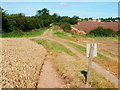
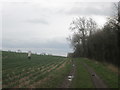
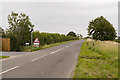
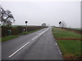
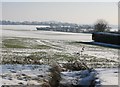
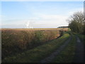
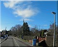
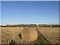
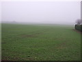
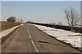
Living in Grove means residing within a small civil parish located approximately two miles south-west of Retford in Nottinghamshire. This quiet countryside settlement covers an area of 5.4 km² and retains a distinctly rural character. The village sits within the parklands of Grove Hall, a large site that separates the community from the town to the north. The A638, known locally as London Road, runs nearby, providing basic road access to the wider region. Despite its modest footprint, the parish has seen a steady population increase. The population stood at 105 according to the 2011 census and grew to 127 by 2021. This growth suggests a stable demographic trend within this secluded location. The landscape is defined by wide verges along parts of the main road and the extensive parklands that dominate the setting. During the Wars of the Roses, the area belonged to families with strong political ties, such as the Hercy family who supported the House of Lancaster. Today, the principal landmark is St Helen's Church, a Grade II listed building with medieval foundations but largely reconstructed in 1882. The village also features the notable site of Castle Hill Wood, which preserves traces of a former motte-and-bailey castle and a wide, deep moat. As a relatively isolated village, daily life here centres on local amenities and the natural surroundings rather than urban convenience.
- Area Type
- Parish
- Area Size
- 5.4 km²
- Population
- Not available
- Population Density
- Not available
Demographics
The community profile in Grove reflects a mature settlement where the median age is 70 years. This high average indicates that the village is predominantly populated by older residents or retirees. Data confirms that the most common age range is simply listed as the total population, meaning the age distribution skews heavily towards this older demographic compared to national averages. Home ownership is the standard arrangement for householders, with 80% of residents owning their property outright or with a mortgage. This high rate of ownership creates a stable, long-term resident base rather than a transient population. The population found a total of 127 individuals in 2021, an increase from the 105 recorded in 2011. This modest growth occurs within a parish that maintains a tight-knit, village feel. While specific data on household composition and accommodation types is not broken down further in the available records, the high home ownership percentage strongly suggests a dominance of freehold properties. The population remains relatively small and ethnically homogenous, consistent with the status of a traditional East Midlands village. Religious diversity is not detailed in the current statistics, but the presence of St Helen's Church serves as the central community focal point. Overall, the demographic profile points to a quiet, low-density living environment catering primarily to those seeking rural retirement or a peaceful country life.
Household Size
Accommodation Type
Tenure
Ethnic Group
Religion
Household Composition
Age
Household Deprivation
NS-SEC
Explore more demographic insights in this area
Go to Demographics tabPlanning
Planning Constraints
- Flood RiskPremium
- Ramsar Wetland SitesPremium
- Area of Outstanding Natural BeautyPremium
- Protected Nature ReservePremium
- Protected WoodlandPremium
- Crime RiskPremium