Area Overview for Grindlow
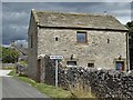
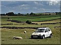
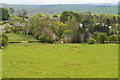
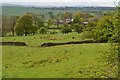
Photos of Grindlow

Area Information
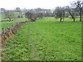
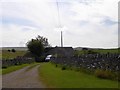
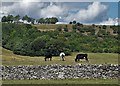
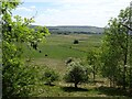
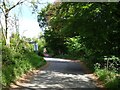
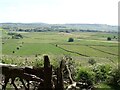
Grindlow is a small civil parish in England covering just 1.2 square kilometres. This modest area size defines the boundaries of a compact community where residents are likely to know one another. Living in Grindlow offers a contained environment where the distance between homes is minimal, fostering a sense of local connection. The parish sits distinct from larger urban centres, providing a quiet setting away from the rush of city life. Daily life here centres on immediate neighbours and the inherent simplicity of a rural settlement. You will find a location that prioritises space and tranquility over high-density living. The geographical limits of the parish mean that everything you need is within a short walk or drive. This compactness is ideal for those who value a clear understanding of their surroundings without the complexity of sprawling suburbs. Grindlow represents a straightforward choice for buyers seeking a defined, small-scale neighbourhood. The area stands as a relic of traditional English parish boundaries, maintaining its character through careful demographic shifts.
- Area Type
- Parish
- Area Size
- 1.2 km²
- Population
- Not available
- Population Density
- Not available
Demographics
The community profile in Grindlow is distinctly mature, with a median age of 70. This figure indicates that the largest concentration of residents falls into the senior demographic. Most households are composed entirely of adults, reflecting the older population that moves to the area after retirement. You will find that the average home has housed one or two individuals for many years rather than growing families. Home ownership is high at 76%, suggesting that the majority of people have purchased their property and intend to stay for the long term. This level of ownership contrasts sharply with areas where rental properties dominate the housing stock. The accommodation types vary, but the ownership rate points to a settled population rather than a transient workforce. Diversity metrics are not detailed in the available records, so the demographic picture relies heavily on age and housing tenure. Deprivation data is absent from the current profile, preventing a full analysis of inequality concerns. Instead, the focus remains on the stability provided by high ownership rates and an older age structure.
Household Size
Accommodation Type
Tenure
Ethnic Group
Religion
Household Composition
Age
Household Deprivation
NS-SEC
Explore more demographic insights in this area
Go to Demographics tabPlanning
Planning Constraints
- Flood RiskPremium
- Ramsar Wetland SitesPremium
- Area of Outstanding Natural BeautyPremium
- Protected Nature ReservePremium
- Protected WoodlandPremium
- Crime RiskPremium