Area Overview for Great Harrowden
Photos of Great Harrowden


Area Information
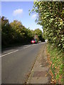
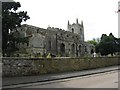
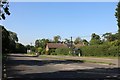
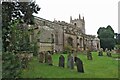
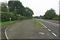
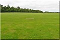
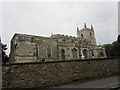
Great Harrowden is a small civil parish covering just 2.9 km² in England. Living in Great Harrowden means residing in a compact, defined locality where every street and green space is part of a tightly knit community. The area is characterised by its small scale, which fosters strong local connections and limits long commutes within the neighbourhood. While the parish lacks extensive urban infrastructure, its size ensures that residents know one another and can navigate their daily routines without complex travel plans. This village setting creates a distinct living environment where the pace of life is generally slower than in larger towns or cities. Prospective buyers will find Great Harrowden to be a quiet retreat, yet the small footprint means that amenities are often within short walking or cycling distances. The community benefits from a strong sense of place, where the boundaries of the parish are well understood by those calling this home. Understanding the layout of Great Harrowden helps you appreciate how the limited land area influences the social fabric.homebuyers should consider how this small size impacts future development potential and local services.
- Area Type
- Parish
- Area Size
- 2.9 km²
- Population
- Not available
- Population Density
- Not available
Demographics
The community in Great Harrowden reflects a distinct life stage, with 80% of residents owning their homes. A significant aspect of living here is knowing you are likely to encounter an older demographic. The median age is 70, indicating that the town centre and streets are dominated by retirees and long-term residents. This age profile shapes the daily rhythm of Great Harrowden, where quiet mornings and leisurely afternoons are common. The high home ownership rate suggests stability, with most households having remained in the area for decades. MostCommonAgeRange data confirms that the population skew towards the elderly is the defining feature of the area. You will find that the social activities and local services cater primarily to those in retirement. The makeup of households revolves around established families who have stayed put, rather than transient populations. This demographic clarity means that schools near Great Harrowden are likely to reflect similar age needs, with a focus on children and young adults in the surrounding regions rather than within the parish itself. The social atmosphere is rooted in tradition and settled communities.
Household Size
Accommodation Type
Tenure
Ethnic Group
Religion
Household Composition
Age
Household Deprivation
NS-SEC
Explore more demographic insights in this area
Go to Demographics tabPlanning
Planning Constraints
- Flood RiskLocked
- Ramsar Wetland SitesLocked
- Area of Outstanding Natural BeautyLocked
- Protected Nature ReserveLocked
- Protected WoodlandLocked
- Crime RiskLocked