Area Overview for Grasby
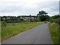
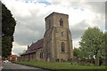
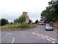
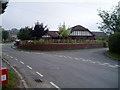
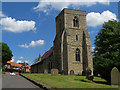
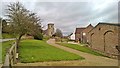
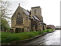
Photos of Grasby


Area Information
Grasby is a compact built-up area spanning 33.7 hectares, nestled in England’s Lincolnshire region. With a median age of 70, it reflects a community predominantly composed of older residents, many of whom have long-standing ties to the area. The high home ownership rate of 82% suggests a stable, settled population, with properties likely occupied by long-term residents rather than transient renters. Daily life in Grasby is shaped by its proximity to essential services: two railway stations—Barnetby and Brigg—offer connections to nearby towns, while Humberside Airport provides regional travel options. The area’s small size means amenities are within practical reach, from local shops to schools. For families, the nearby Grasby All Saints Church of England Primary School, rated ‘good’ by Ofsted, offers a solid foundation for education. Grasby’s character is defined by its quiet, community-focused atmosphere, where convenience and accessibility meet the needs of its older demographic.
- Area Type
- Built Up Area 250
- Area Size
- 33.7 hectares
- Population
- Not available
- Population Density
- Not available
Grasby’s lifestyle is shaped by its proximity to essential amenities. Within practical reach are five retail venues, including Lincolnshire Co-operative Co and Morrisons Daily, offering everyday shopping needs. The area’s two railway stations and Humberside Airport provide easy access to nearby towns and regional travel. While parks or leisure facilities are not specified in the data, the presence of multiple retail and transport options suggests a convenient, self-contained environment. The quiet, community-focused nature of Grasby complements its accessibility, making it suitable for those prioritising stability and ease of movement over large-scale leisure options.
Amenities
Schools
The primary school serving Grasby is Grasby All Saints Church of England Primary School, which holds a ‘good’ Ofsted rating. This institution is the sole named school in the data, indicating that families in the area rely on this single primary school for their children’s early education. The absence of secondary schools or other educational institutions in the data suggests that students may need to travel to nearby towns for further education. For parents, the ‘good’ rating provides reassurance about the quality of primary education available, though the limited range of schools may require careful planning for secondary schooling.
| Rank | School | Type | Entry gender | Ages |
|---|
Explore more schools in this area
Go to Schools tabDemographics
Grasby’s population is predominantly older, with a median age of 70, indicating a community where retirees and long-term residents form the majority. Home ownership is exceptionally high at 82%, suggesting most residents are homeowners rather than renters. The data does not specify household composition or ethnic diversity, but the ‘total’ figures for accommodation type and predominant ethnic group imply a lack of detailed breakdowns. This demographic profile shapes the area’s social fabric: a stable, low-turnover population with established routines. While no deprivation data is provided, the high home ownership and low crime risk suggest a relatively secure, self-sufficient community. For residents, this translates to a lifestyle centered on familiarity, with limited pressure from transient populations or rapid development.
Household Size
Accommodation Type
Tenure
Ethnic Group
Religion
Household Composition
Age
Household Deprivation
NS-SEC
Explore more demographic insights in this area
Go to Demographics tabPlanning
Planning Constraints
- Crime RiskPremium