Area Overview for Grantham St. Vincent's Ward
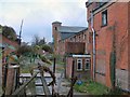
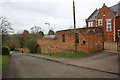
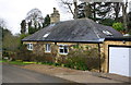
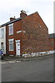
Photos of Grantham St. Vincent's Ward

Area Information
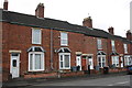
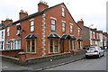
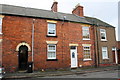
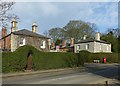
Grantham St. Vincent's Ward is a compact district occupying just 2.8 square kilometres within the Borough Unitary authority. Life here is defined by its small scale and specific demographic composition. You are entering an area where the residents are notably older than the national average, with a median age of 70 years. This distinguishes the ward as a community of retirees rather than families raising children or young professionals starting careers. Your daily routine will be shaped by a neighbourhood designed for a slower pace, where the primary occupants are those enjoying the retirement years. The small geographical footprint means you can move between different parts of the ward quickly, yet the social environment remains Insulated to an older generation. When considering moving to this ward, understand that the community rhythm aligns with the needs of pensioners and Silver surfers. There are no mixed-age developments or student housing clusters to disrupt the established atmosphere. You are buying into a specific lifestyle where the demographic makeup is the single most defining feature. The lack of younger residents suggests limited demand for typical family amenities or schools in the immediate vicinity. Your future in Grantham St. Vincent's Ward will likely involve close proximity to neighbours of a similar vintage.
- Area Type
- District Borough Unitary Ward
- Area Size
- 2.8 km²
- Population
- Not available
- Population Density
- Not available
Demographics
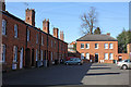
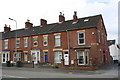
The community in Grantham St. Vincent's Ward is heavily weighted towards older residents, with a median age of 70. This statistic confirms that the population consists primarily of retirees. The household composition and predominant ethnic group data are not specified, so you must rely on the age profile to understand the social fabric. Five out of every ten households here are owner-occupied, representing a 58% rate. This indicates that buying into this ward is the standard route for securing accommodation, rather than renting. The accommodation type breakdown is not provided, preventing any conclusion about whether properties are detached houses, flats, or bungalows. You cannot assume the housing stock is predominantly one type based on the available figures. However, the high proportion of owner-occupiers suggests a stable, long-term resident base. Deprivation data is absent from the current records, so you lack information on income levels or council tax bands. For a prospective buyer, the 58% ownership rate is the clearest indicator of tenure. It signals an area where people stay put and invest in their homes rather than moving frequently. The absence of data on ethnic diversity means you cannot make claims about community inclusivity or cultural variety. You are entering a monolithic age group where social interactions likely depend on age-based interests rather than generational mixing.
Household Size
Accommodation Type
Tenure
Ethnic Group
Religion
Household Composition
Age
Household Deprivation
NS-SEC
Explore more demographic insights in this area
Go to Demographics tabPlanning
Planning Constraints
- Flood RiskPremium
- Ramsar Wetland SitesPremium
- Area of Outstanding Natural BeautyPremium
- Protected Nature ReservePremium
- Protected WoodlandPremium
- Crime RiskPremium