Area Overview for Grantham Springfield Ward
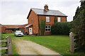
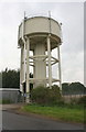
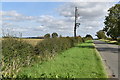
Photos of Grantham Springfield Ward


Area Information
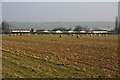
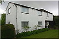
Grantham Springfield Ward occupies a strategic position within the South Kesteven district of Lincolnshire. This 3.9 km² electoral ward lies in the south-eastern part of Grantham's urban area, situated near the A52 road. Its location places residents adjacent to neighbouring areas such as Londonthorpe and Harrowby Without. The ward operates as part of the broader town of Grantham, forming the unitary ward with the ONS code E05010165. Geographically, it sits at approximately 52.8949°N latitude and -0.6461°W longitude. A 2021 census record indicated a population of 5,571 people living here. The area benefits from proximity to Grantham railway station, which provides services north to Lincoln and south towards London. Transport links are further supported by the A52, which connects to the A1 road forming Grantham's western boundary. Living in Grantham Springfield Ward means accessing these major arterial roads while remaining close to the town centre. The settlement is compact enough to offer a defined neighbourhood feel yet connected to the wider East Midlands region through its transport infrastructure.
- Area Type
- District Borough Unitary Ward
- Area Size
- 3.9 km²
- Population
- Not available
- Population Density
- Not available
Demographics
The community composition within this ward reveals a distinctly mature population profile. The median age for residents stands at 70 years old, making this one of the oldest wards in the country. Although the most common age range data is listed as 'Age: Total', the high median figure confirms that you are looking at a neighbourhood dominated by older adults. Home ownership rates sit at 51 per cent, indicating that exactly half of the households own their property outright or with a mortgage. The remaining 49 per cent likely occupy renter accommodation. While specific data on ethnic groups, religious affiliations, and detailed household composition totals are not explicitly broken down in the provided records, the demographic reality is clear: this is an area where the elderly are the primary demographic group. The concentration of older residents suggests a community where local amenities likely cater to specific age-related needs rather than a mixed generation workforce. When considering living in Grantham Springfield Ward, expectations must align with this singular focus on a senior-heavy population rather than a diverse, multi-generational mixing pot.
Household Size
Accommodation Type
Tenure
Ethnic Group
Religion
Household Composition
Age
Household Deprivation
NS-SEC
Explore more demographic insights in this area
Go to Demographics tabPlanning
Planning Constraints
- Flood RiskPremium
- Ramsar Wetland SitesPremium
- Area of Outstanding Natural BeautyPremium
- Protected Nature ReservePremium
- Protected WoodlandPremium
- Crime RiskPremium