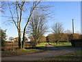
Area Overview for Gonalston
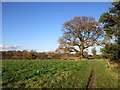
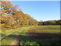
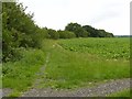
Photos of Gonalston


Area Information
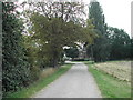
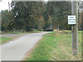
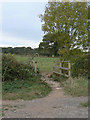
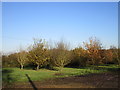
Gonalston is a civil parish covering an area of 4.4 km² in England. This relatively small footprint defines a compact community where daily life moves at a steadier pace than in larger urban centres. The locality offers a defined sense of place without the sprawl of surrounding major towns. You will find homes in Gonalston situated within a specific boundary that keeps neighbours close, fostering a neighbourhood dynamic typical of village life. The geography supports a residential focus, meaning your daily routine likely centres on local amenities rather than a commute to a distant city. Living in Gonalston means engaging with an environment where the physical limits of the parish provide a clear, manageable setting for family life and outdoor activity. The area's size ensures that travel across the parish is quick, yet the distinct identity of Gonalston remains intact against the backdrop of the wider county. Prospective homeowners should appreciate that this specific 4.4 km² stretch of land offers a contained lifestyle where the transition between home and community feels immediate and direct.
- Area Type
- Parish
- Area Size
- 4.4 km²
- Population
- Not available
- Population Density
- Not available
Demographics
The community in Gonalston presents a clear demographic profile. You will find that the median age stands at 70 years. This figure indicates that the population is mature, suggesting the local schools near Gonalston cater to a different age cohort than the primary residential stock. Most residents fall into the "Age: Total" category, reflecting a settled population rather than one dominated by young families or transient workers. Home ownership is high, with 76% of dwellings owned outright or with a mortgage. This statistic signals a neighbourhood where people put down long-term roots. The household composition data covers the total population, showing a mix of living arrangements typical of an older demographic. Accommodation types reflect this maturity, pointing towards a stock likely comprised of established housing rather than new developments. The ethnic diversity data reflects the total population, though the dominant group is not explicitly named in the available records for this specific parish. Understanding these figures helps you gauge the social fabric. You are looking at an area where long-term residents own their homes, and the population structure is stable and established.
Household Size
Accommodation Type
Tenure
Ethnic Group
Religion
Household Composition
Age
Household Deprivation
NS-SEC
Explore more demographic insights in this area
Go to Demographics tabPlanning
Planning Constraints
- Flood RiskPremium
- Ramsar Wetland SitesPremium
- Area of Outstanding Natural BeautyPremium
- Protected Nature ReservePremium
- Protected WoodlandPremium
- Crime RiskPremium