Area Overview for Goltho
Photos of Goltho


Area Information
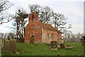
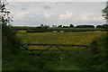
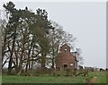
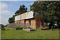
Goltho is a small civil parish in Lincolnshire covering just 5.6 square kilometres. Living in Goltho means settling into a compact rural environment where the community is close-knit and the distance to your neighbours is short. This area serves as a quiet retreat for those who prefer a slower pace of life away from urban pressures. The landscape is defined by its agricultural roots and open countryside rather than dense development. You will find that daily life here revolves around local amenities and easy access to the surrounding fields and farmland. The small scale of the parish ensures that you are never far from the centre or the edge of the land. It is an established settlement that has remained relatively unchanged in size and character. Prospective buyers looking for seclusion without leaving the county will find Goltho to be a practical choice. The compact nature of the land means that infrastructure is manageable and access to local points of interest is direct. There are no major highways cutting through the immediate vicinity, which contributes to a peaceful daily routine. Your view from most homes in Goltho likely includes green spaces or farmland rather than heavy traffic. The area functions as a self-contained village unit within the larger rural district. ### The community in Goltho is distinctively mature, reflecting a population that has aged significantly over recent years. The median age for residents is 70, which is considerably higher than the national average. You will find that the majority of people living in Goltho fall within the older age bracket, creating a quiet and settled atmosphere. Home ownership stands at an impressive 81 per cent, indicating that the vast majority of households are owned outright or with a mortgage rather than rented. This high rate of ownership suggests a stable, long-term population with deep local roots. The demographic profile points toward a retirement destination or a village attracting older families who have stayed through adulthood. Most households consist of single adults, couples, or perhaps empty nesters living in comfortable stability. There is little evidence of transient living arrangements or high churn in the residential sector. The social fabric reflects this older demographic, with community interactions often centred around local clubs, charities, or family gatherings rather than the fast-paced lifestyles of younger urbanites. When considering buying homes in Goltho, you are entering a market where social networks are established and enduring. The lack of young families or students means that the village has a calm rhythm to its week. ### The housing market in Goltho is characterised almost entirely by owner-occupancy, with 81 per cent of dwellings held by those who own them. This suggests a market where properties are built for long-term stays rather than short-term investment or student rentals. When looking at accommodation types in Goltho, the stock is likely dominated by family homes and cottages suitable for settling down. You will not find a significant proportion of private rentals or purpose-built student accommodation in this parish. The high ownership rate means that sellers are often looking to upgrade or downsize rather than move on from a rental agreement. This dynamic can sometimes lengthen the time a property stays on the market as matches are sought between specific buyer needs and existing stock. Homes in Goltho tend to be suited to retirement or empty-nester lifestyles, supporting the median age of seventy. There are few buy-to-lease opportunities available here, making the area attractive for those seeking a permanent home. The prevalence of owner-occupied houses indicates a stable community where neighbours have likely lived in the same properties for decades. If you are thinking of buying a home in Goltho, you are joining a community where property tenure is private and secure. ### Digital connectivity in Goltho presents a mixed picture for modern residents relying on internet services. Mobile coverage is generally strong with a score of 82 out of 100, meaning you can expect reliable network access for calls and data across most of the parish. However, fixed broadband quality scores only 3 out of 100, which indicates significant limitations for households depending on high-speed internet for work or streaming. This low broadband score suggests that uploading large files, video conferencing, or downloading heavy software might be slow or frustrating for you. If you plan to work from home in Goltho, you must verify the specific broadband availability at any property before committing to a purchase. The disparity between mobile and fixed-line services means that while you may have a good phone signal, your internet connection could struggle to keep up with demanding household needs. This situation is common in rural parishes with limited fibre optic infrastructure. Residents who rely heavily on digital services should consider the potential inconvenience of patchy fixed-line speeds. For occasional browsing and mobile usage, the area serves adequately, but serious work-from-home requirements may be challenged. ### Living in Goltho offers reassurance regarding crime and environmental risks, with most assessments falling within safe parameters. Crime risk is low with a safety score of 76 out of 100, placing this neighbourhood below the national average for criminal activity. You can expect a peaceful environment where security concerns are minimal for daily life. Environmental safety checks also show positive results, with flood risk rated as low and a specific score of 1.19 indicating very little threat of waterlogging. There are no Ramsar wetland sites or Areas of Outstanding Natural Beauty covering the parcel, which simplifies planning constraints compared to more sensitive regions. However, there is one notable planning consideration to be aware of. The parish contains protected woodland, which carries a warning level assessment with a score of 11.87 out of 100. This means that while there is no high-impact environmental hazard, development plans must account for existing conservation areas. You must respect these protections if you wish to undertake extensions or significant landscaping near the woodland boundaries. Overall, Goltho presents a secure and stable living environment where both personal safety and structural stability are high priorities for residents. ### What makes the community feel like home in Goltho?Goltho is a mature village where the median resident age is 70. This older demographic creates a stable social environment with an 81 per cent home ownership rate. Most people living in Goltho have settled long-term, resulting in a quiet, established neighbourhood free from the transient nature of larger towns. How reliable is internet and mobile connectivity for residents?Mobile coverage is good with a quality score of 82, providing reliable phone and data services across the parish. However, fixed broadband is poor, scoring only 3 out of 100. Residents relying on high-speed internet for work may face significant delays unless they can access a boost point or specific fibre lines. Is it safe to live in Goltho regarding crime and flooding?The area scores 76 on a safety scale, indicating below-average crime rates and a low risk of illegal activity. Flood risk is also minimal with a score of 1.19 out of 100. The only planning constraint is protected woodland, which scores 11.87, requiring builders to respect conservation boundaries.
- Area Type
- Parish
- Area Size
- 5.6 km²
- Population
- Not available
- Population Density
- Not available
Demographics
The community in Goltho is distinctively mature, reflecting a population that has aged significantly over recent years. The median age for residents is 70, which is considerably higher than the national average. You will find that the majority of people living in Goltho fall within the older age bracket, creating a quiet and settled atmosphere. Home ownership stands at an impressive 81 per cent, indicating that the vast majority of households are owned outright or with a mortgage rather than rented. This high rate of ownership suggests a stable, long-term population with deep local roots. The demographic profile points toward a retirement destination or a village attracting older families who have stayed through adulthood. Most households consist of single adults, couples, or perhaps empty nesters living in comfortable stability. There is little evidence of transient living arrangements or high churn in the residential sector. The social fabric reflects this older demographic, with community interactions often centred around local clubs, charities, or family gatherings rather than the fast-paced lifestyles of younger urbanites. When considering buying homes in Goltho, you are entering a market where social networks are established and enduring. The lack of young families or students means that the village has a calm rhythm to its week. ### The housing market in Goltho is characterised almost entirely by owner-occupancy, with 81 per cent of dwellings held by those who own them. This suggests a market where properties are built for long-term stays rather than short-term investment or student rentals. When looking at accommodation types in Goltho, the stock is likely dominated by family homes and cottages suitable for settling down. You will not find a significant proportion of private rentals or purpose-built student accommodation in this parish. The high ownership rate means that sellers are often looking to upgrade or downsize rather than move on from a rental agreement. This dynamic can sometimes lengthen the time a property stays on the market as matches are sought between specific buyer needs and existing stock. Homes in Goltho tend to be suited to retirement or empty-nester lifestyles, supporting the median age of seventy. There are few buy-to-lease opportunities available here, making the area attractive for those seeking a permanent home. The prevalence of owner-occupied houses indicates a stable community where neighbours have likely lived in the same properties for decades. If you are thinking of buying a home in Goltho, you are joining a community where property tenure is private and secure. ### Digital connectivity in Goltho presents a mixed picture for modern residents relying on internet services. Mobile coverage is generally strong with a score of 82 out of 100, meaning you can expect reliable network access for calls and data across most of the parish. However, fixed broadband quality scores only 3 out of 100, which indicates significant limitations for households depending on high-speed internet for work or streaming. This low broadband score suggests that uploading large files, video conferencing, or downloading heavy software might be slow or frustrating for you. If you plan to work from home in Goltho, you must verify the specific broadband availability at any property before committing to a purchase. The disparity between mobile and fixed-line services means that while you may have a good phone signal, your internet connection could struggle to keep up with demanding household needs. This situation is common in rural parishes with limited fibre optic infrastructure. Residents who rely heavily on digital services should consider the potential inconvenience of patchy fixed-line speeds. For occasional browsing and mobile usage, the area serves adequately, but serious work-from-home requirements may be challenged. ### Living in Goltho offers reassurance regarding crime and environmental risks, with most assessments falling within safe parameters. Crime risk is low with a safety score of 76 out of 100, placing this neighbourhood below the national average for criminal activity. You can expect a peaceful environment where security concerns are minimal for daily life. Environmental safety checks also show positive results, with flood risk rated as low and a specific score of 1.19 indicating very little threat of waterlogging. There are no Ramsar wetland sites or Areas of Outstanding Natural Beauty covering the parcel, which simplifies planning constraints compared to more sensitive regions. However, there is one notable planning consideration to be aware of. The parish contains protected woodland, which carries a warning level assessment with a score of 11.87 out of 100. This means that while there is no high-impact environmental hazard, development plans must account for existing conservation areas. You must respect these protections if you wish to undertake extensions or significant landscaping near the woodland boundaries. Overall, Goltho presents a secure and stable living environment where both personal safety and structural stability are high priorities for residents. ### What makes the community feel like home in Goltho?Goltho is a mature village where the median resident age is 70. This older demographic creates a stable social environment with an 81 per cent home ownership rate. Most people living in Goltho have settled long-term, resulting in a quiet, established neighbourhood free from the transient nature of larger towns. How reliable is internet and mobile connectivity for residents?Mobile coverage is good with a quality score of 82, providing reliable phone and data services across the parish. However, fixed broadband is poor, scoring only 3 out of 100. Residents relying on high-speed internet for work may face significant delays unless they can access a boost point or specific fibre lines. Is it safe to live in Goltho regarding crime and flooding?The area scores 76 on a safety scale, indicating below-average crime rates and a low risk of illegal activity. Flood risk is also minimal with a score of 1.19 out of 100. The only planning constraint is protected woodland, which scores 11.87, requiring builders to respect conservation boundaries.
Household Size
Accommodation Type
Tenure
Ethnic Group
Religion
Household Composition
Age
Household Deprivation
NS-SEC
Explore more demographic insights in this area
Go to Demographics tabPlanning
Planning Constraints
- Flood RiskPremium
- Ramsar Wetland SitesPremium
- Area of Outstanding Natural BeautyPremium
- Protected Nature ReservePremium
- Protected WoodlandPremium
- Crime RiskPremium