Area Overview for Glentworth
Photos of Glentworth
Area Information
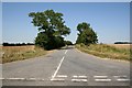
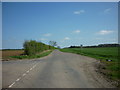
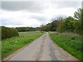
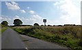
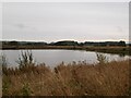
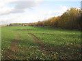
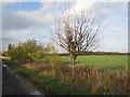
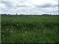
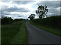
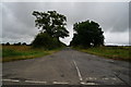
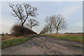
Glentworth is a compact civil parish in England covering an area of 12.6 km². Life here is defined by its rural character and strong sense of local history. You will find a settlement that functions independently while remaining connected to the wider county. The environment is largely open, without the constraints of large protected nature reserves or designated areas of outstanding natural beauty within its boundaries. This openness allows for straightforward land use planning in many parts of the parish. You are likely to experience a quiet daily routine where the pace is set by local rather than urban rhythms. The parish is small enough that you can walk between key points, yet it has sufficient land area to support varied landscapes. Living in Glentworth means accepting a lifestyle where services are accessed via road networks rather than walking distance from a town centre. The area offers a straightforward prospect for buyers who value space and lower density. There are no ambitious planning constraints involving wetlands or woodlands that might complicate development or land management. You will find a distinct absence of major nature reserves within the parish limits. This results in a clear landscape character where the rural form remains unaltered by protected designation. Your days here will lack the noise and crowds associated with larger towns.
- Area Type
- Parish
- Area Size
- 12.6 km²
- Population
- Not available
- Population Density
- Not available
Demographics
The community within Glentworth reflects a very specific age profile. The median age of residents is 70, indicating a population dominated by older adults. While specific data on individual age ranges is not detailed, the overall figure suggests a significantly senior community compared to national averages. Home ownership stands at 76%, which means the majority of people live in properties they own outright or have a substantial mortgage rather than renting. This high ownership rate often correlates with long-term residents who have stayed in the area through different life stages. Household compositions and predominant ethnic groups are recorded as totals in the available statistics, meaning the specific breakdown is not currently itemised. You can expect a neighbourhood where established families may have been present for decades. Religion and other cultural demographics are also recorded as aggregate figures, offering no specific breakdown of beliefs or practices. The high level of home ownership suggests stability within the housing stock. When living in Glentworth, you join a community where financial commitment to property is high. This dynamic often reduces vacancy rates and encourages neighbours to invest in their immediate surroundings. The demographic reality is one of a mature population where the primary driver of housing demand is likely reinvestment rather than new entry.
Household Size
Accommodation Type
Tenure
Ethnic Group
Religion
Household Composition
Age
Household Deprivation
NS-SEC
Explore more demographic insights in this area
Go to Demographics tabPlanning
Planning Constraints
- Flood RiskPremium
- Ramsar Wetland SitesPremium
- Area of Outstanding Natural BeautyPremium
- Protected Nature ReservePremium
- Protected WoodlandPremium
- Crime RiskPremium