Area Overview for Glenfields
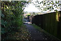
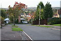
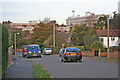
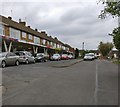
Photos of Glenfields

Area Information
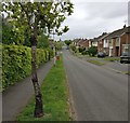
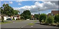
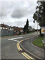
Glenfields is a civil parish in England that covers an area of 5.1 km². Despite its small geographic footprint, the location holds a population of 1574 residents. This density results in an average of 311 people per square kilometre, creating a compact community layout. Living in Glenfields means occupying a defined area where every resident is relatively close to their neighbour. The village functions as a self-contained unit rather than sprawling into the surrounding countryside. You will find a settlement that prioritises its internal structure over extensive expansion. Daily life here revolves around the practicalities of a small parish. The population size suggests a close-knit environment rather than an anonymous urban setting. There is a clear distinction between Glenfields as a residential zone and the wider rural landscape that borders it. Potential buyers looking for homes in Glenfields should expect a layout designed for inhabitants to know one another. The area maintains a specific identity separate from larger towns, offering a specific type of rural living experience. Understanding these boundaries helps you visualise exactly where your new home would sit within the parish.
- Area Type
- Parish
- Area Size
- 5.1 km²
- Population
- 1574
- Population Density
- 311 people/km²
Demographics
The community profile of Glenfields reveals an older population with a median age of 70. This statistic indicates that the most common age range corresponds to mature residents. You are more likely to encounter retirees or older adults than young families or teenagers when walking the streets. This demographic shift influences the pace of life and the kinds of amenities that hold local importance. With 83% of households owned outright, home ownership defines the majority of people living here. This high rate of ownership suggests long-term stability within the community. The household composition in Glenfields reflects this older demographic trend. Most families have likely lived in their properties for decades, resulting in a settled population. The accommodation types in the parish cater primarily to the needs of this age group. You will find that the residents value permanence over mobility, which aligns with the high ownership figures. The crime risk score stands at 66 out of 100, which places the area in the warning category for medium crime risk. While rates remain around the national average, standard security precautions are advisable for any homeowner. This balanced view ensures you understand the safety landscape without minimalising potential risks. The diversity of the area is less focused on age groups and more on how these residents share common living arrangements.
Household Size
Accommodation Type
Tenure
Ethnic Group
Religion
Household Composition
Age
Household Deprivation
NS-SEC
Explore more demographic insights in this area
Go to Demographics tabPlanning
Planning Constraints
- Flood RiskPremium
- Ramsar Wetland SitesPremium
- Area of Outstanding Natural BeautyPremium
- Protected Nature ReservePremium
- Protected WoodlandPremium
- Crime RiskPremium