Area Overview for Glenfield Faire Ward
Photos of Glenfield Faire Ward
Area Information
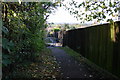
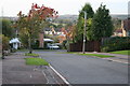
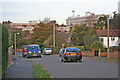
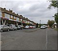
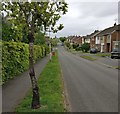
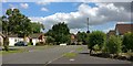
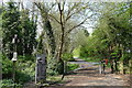
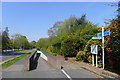
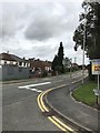
Living in Glenfield Faire Ward offers a distinct experience within the Blaby District Council area of Leicestershire. This electoral ward encompasses approximately 2.1 km² of land, centred around the coordinates defining the modern village. The area sits strategically between Leicester City, the villages of Anstey and Groby, and the adjoining Charnwood Borough to the north. A defined settlement boundary in the Glenfield Neighbourhood Plan clearly distinguishes developed housing zones from the surrounding countryside. First mentioned historically as Clenefelde and owned by a Normandy abbey, the locale has evolved from a site controlled by the Earls of Leicester to the home of Roger de Glenfield. Historical records also indicate a Bronze Age settlement near modern Blackthorn Road and a confirmed Roman road nearby. Today, the parish, officially known as Glenfields but understood as Glenfield, possesses an attractive conservation area supported by important open spaces. Sites of natural environment significance are protected within the Neighbourhood Plan to preserve the local character. Residents benefit from a medium-sized commercial corridor featuring the Optimus Point and Mill Lane sites, which serve the daily needs of the community. Proximity to the M1 and A46 roads further integrates this part of the East Midlands with wider regional transport networks.
- Area Type
- District Borough Unitary Ward
- Area Size
- 2.1 km²
- Population
- Not available
- Population Density
- Not available
Demographics
The community profile in Glenfield Faire Ward reflects a mature population with a median age of 70 years. The most common age range among residents aligns with this high median figure, suggesting a settlement dominated by older demographics. This age profile indicates a quiet residential environment where many local families may have moved on to other areas decades ago. Home ownership stands at 84%, creating a highly stable community where most residents have established long-term ties to their properties. High ownership rates typically correlate with lower short-term tenant turnover and a shared sense of community investment. The ward does not show specific data regarding household composition, predominant ethnic groups, or religious affiliations, but the high home ownership percentage offers a clear picture of the area's stability. For those considering homes in Glenfield, the lack of rental density suggests a traditional neighbourhood where neighbours often know each other through decades of residence. Safety assessments reinforce this stable environment, with crime risk levels indicating below-average crime rates for the region. The combination of an older demographic and high property ownership creates a settled atmosphere distinct from areas with younger student populations or high rental turnover.
Household Size
Accommodation Type
Tenure
Ethnic Group
Religion
Household Composition
Age
Household Deprivation
NS-SEC
Explore more demographic insights in this area
Go to Demographics tabPlanning
Planning Constraints
- Flood RiskPremium
- Ramsar Wetland SitesPremium
- Area of Outstanding Natural BeautyPremium
- Protected Nature ReservePremium
- Protected WoodlandPremium
- Crime RiskPremium