Area Overview for Glapthorn
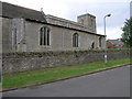
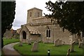
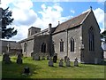
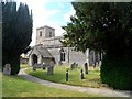
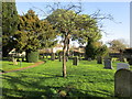
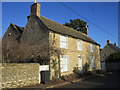
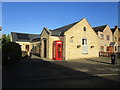
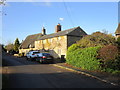
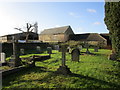
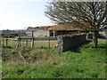
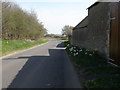
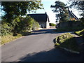
Photos of Glapthorn
Area Information
Glapthorn is a compact built-up area in England, covering 22.3 hectares. Its size suggests a tight-knit community, where daily life is likely shaped by proximity to local amenities and services. The area’s median age of 70 indicates a population skewed towards older residents, which may influence the pace of life and community dynamics. Despite its small footprint, Glapthorn offers access to essential services, including retail options and a primary school. Homeownership is high, with 79% of properties owner-occupied, suggesting a stable residential base. For those considering living here, the combination of low crime risk and practical amenities may appeal to buyers seeking a quiet, established neighbourhood. The presence of a Church of England Primary School highlights the area’s focus on family-friendly infrastructure, while the broadband and mobile connectivity scores reflect modern-day convenience. Glapthorn’s character is defined by its balance of tradition and practicality, making it a viable option for those prioritising safety and community over urban vibrancy.
- Area Type
- Built Up Area 250
- Area Size
- 22.3 hectares
- Population
- Not available
- Population Density
- Not available
Residents of Glapthorn have access to a range of retail options within practical reach, including Waitrose Oundle, Tesco Oundle, and Co-op Oundle. These stores provide convenience for everyday shopping, from groceries to household goods. While the data does not specify other amenities like parks or leisure facilities, the presence of multiple retail outlets suggests a focus on practicality and accessibility. The area’s compact size likely means that essential services are within walking or short driving distance, supporting a lifestyle that prioritises ease of access over expansive recreational spaces. The combination of retail options and the area’s safety profile may appeal to those seeking a straightforward, low-maintenance living environment.
Amenities
Schools
Glapthorn Church of England Primary School is the only school explicitly listed in the data, serving the area’s primary education needs. As a Church of England institution, it may align with specific religious or educational values, though its Ofsted rating is not provided. The absence of secondary schools or other educational institutions suggests that families may need to look beyond Glapthorn for comprehensive schooling. This could be a consideration for prospective buyers with children, as the proximity to a single primary school may not meet all educational requirements. The school’s presence, however, indicates a focus on local provision for younger children, which could be a draw for families prioritising community-based education.
| Rank | School | Type | Entry gender | Ages |
|---|
Explore more schools in this area
Go to Schools tabDemographics
Glapthorn’s population has a median age of 70, the highest recorded figure, indicating a predominantly older demographic. This suggests a community where retirees or long-term residents form the majority. Homeownership stands at 79%, a strong indicator of long-term residency and financial stability. The data does not specify household composition or accommodation types, but the high home ownership rate implies a mix of owner-occupied properties, possibly including semi-detached or terraced homes. Ethnicity and religion are not detailed, but the figures provided are aggregated, meaning no breakdown by group is available. The absence of specific data on diversity or deprivation means these aspects cannot be assessed. For buyers, the age profile and ownership rates suggest a mature, settled population, which may influence local services and amenities.
Household Size
Accommodation Type
Tenure
Ethnic Group
Religion
Household Composition
Age
Household Deprivation
NS-SEC
Explore more demographic insights in this area
Go to Demographics tabPlanning
Planning Constraints
- Crime RiskPremium