Area Overview for Gedney Ward
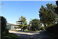
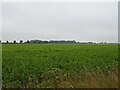
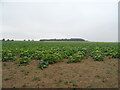
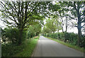
Photos of Gedney Ward
Area Information
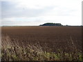
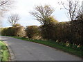
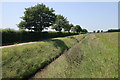
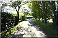
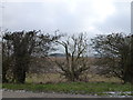
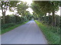
Gedney Ward occupies 77.9 square kilometres of flat land in East Midlands England. It functions as an electoral ward within South Holland District Council and includes the civil parish of Gedney. This area encompasses the main village along with several hamlets, including Gedney Broadgate, Gedney Drove End, Gedney Dyke, Gedney Marsh and Dawsmere. The landscape consists largely of reclaimed fenland that supports one of the most intensive crop-growing operations in the United Kingdom. Reviewers should expect a rural setting located approximately two miles east of Holbeach and two miles north-west of Long Sutton. The parish extends eastward toward The Wash, creating a vast open horizon typical of the region. You will find major roads such as the A17 bordering the area to the north, providing links between Boston and King's Lynn. National Cycle Route 1 also passes directly through the parish, offering connectivity for cyclists. A key landmark is St Mary Magdalene church, which residents know locally as the Cathedral of the Fens. The proximity to the RAF Holbeach bombing range adds to the local character, with observation towers situated on the sea wall near Dawsmere and Gedney Drove End. Living here means embracing a life close to the soil with significant agricultural activity defining the daily rhythm.
- Area Type
- District Borough Unitary Ward
- Area Size
- 77.9 km²
- Population
- Not available
- Population Density
- Not available
Demographics
The community of Gedney Ward exhibits a distinctly older population profile compared to national averages. Census data records the median age of residents at 70 years, indicating a significant proportion of elderly households within the ward. This demographic trait shapes the local services and social environment, creating a neighbourhood where multi-generational needs often require careful consideration. Home ownership stands at a high level, with 76 percent of dwellings owned outright or with a mortgage. This figure suggests a stable residential base where long-term residents have established roots in the area. The area size of 77.9 square kilometres covers the civil parish and its surrounding hamlets, diluting population density across this extensive rural expanse. While the most common age range covers the total population, the specific breakdown reinforces the dominance of older age groups. This demographic reality implies that local shops and community groups likely cater primarily to older adults. You should prepare for a quiet settlement where the pace of life reflects the needs and rhythms of an ageing populace. The high ownership rate combined with the large land area creates a sense of permanence within this agricultural district.
Household Size
Accommodation Type
Tenure
Ethnic Group
Religion
Household Composition
Age
Household Deprivation
NS-SEC
Explore more demographic insights in this area
Go to Demographics tabPlanning
Planning Constraints
- Flood RiskPremium
- Ramsar Wetland SitesPremium
- Area of Outstanding Natural BeautyPremium
- Protected Nature ReservePremium
- Protected WoodlandPremium
- Crime RiskPremium