Area Overview for Gartree
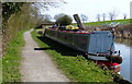
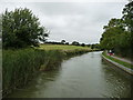
Photos of Gartree


Area Information
Gartree is a compact built-up area in England, spanning 22.1 hectares. Its character is defined by a stable, mature population, with a median age of 70, suggesting a community rooted in long-term residency. The area is well-connected, with Market Harborough Railway Station providing access to regional transport networks. While the size is modest, the proximity to retail outlets such as M&S Market Harborough BP, Co-op Leicester, and Spar ensures daily needs are met without long commutes. Home ownership is high, at 79%, indicating a settled demographic. Living in Gartree offers a blend of practicality and quietude, with a focus on local amenities and straightforward access to nearby towns. For buyers seeking a low-maintenance, community-oriented environment, Gartree provides a straightforward proposition: a small, stable area with essential services within reach.
- Area Type
- Built Up Area 250
- Area Size
- 22.1 hectares
- Population
- Not available
- Population Density
- Not available
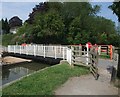
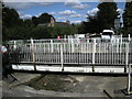
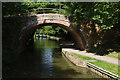
Residents of Gartree have access to essential retail and transport services within practical reach. The M&S Market Harborough BP, Co-op Leicester, and Spar provide nearby shopping options for groceries and daily necessities, reducing the need for longer trips. The Market Harborough Railway Station connects the area to broader regional networks, facilitating travel to larger towns and cities. While the data does not specify parks or leisure facilities, the compact size of Gartree suggests that amenities are likely within walking distance. The character of the area is defined by its practicality: a focus on local services and straightforward access to transport. For those valuing convenience over expansive leisure options, Gartree offers a functional lifestyle with minimal effort required for daily errands or travel.
Amenities
Schools
| Rank | A + A* % | School | Type | Entry gender | Ages |
|---|
Explore more schools in this area
Go to Schools tabDemographics
Gartree’s population is predominantly older, with a median age of 70, reflecting a community where retirement is the norm. This age profile suggests a demographic with established routines and a preference for settled living. Home ownership is strong, at 79%, indicating that most residents are long-term property holders. The data does not specify household composition or accommodation types, but the high ownership rate suggests a mix of family homes and single-occupancy properties. The area’s demographics do not highlight significant ethnic or religious diversity, as the figures provided are aggregated. For residents, this translates to a stable, low-turnover environment where community ties are likely to be strong. The lack of detailed diversity metrics means the area’s social fabric remains opaque, but the age and ownership data paint a picture of a mature, self-sufficient population.
Household Size
Accommodation Type
Tenure
Ethnic Group
Religion
Household Composition
Age
Household Deprivation
NS-SEC
Explore more demographic insights in this area
Go to Demographics tabPlanning
Planning Constraints
- Crime RiskLocked