Area Overview for Gainsborough East Ward
Photos of Gainsborough East Ward


Area Information
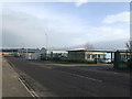
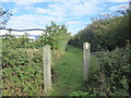
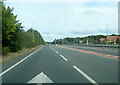
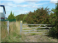
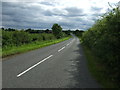
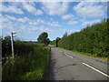
Living in Gainsborough East Ward offers a distinct experience within the market town of Gainsborough, Lincolnshire. This electoral ward occupies a small patch of land measuring just 4.7 square kilometres, yet it holds a significant population of 7,477 residents. The location sits on the east bank of the River Trent at coordinates 53.3926°N, -0.7529°W, placing it strategically within the West Lindsey district. You are situated approximately 18 miles north-west of Lincoln and 16 miles south-west of Scunthorpe, providing reasonable access to major regional hubs like Doncaster and Sheffield. The ward extends south into rural areas near Lea, encompassing natural paths along Warren Wood, Lea Wood, and Bass Wood. Historical significance permeates the area, with landmarks such as Gainsborough Old Hall and the Church of All Saints anchoring the town's identity. The civil parish boundaries include routes like the A631 Thorndike Way and the B1433, connecting you to the wider network. Whether you are drawn to the heritage of medieval times or the practicality of the Trent Valley location, Gainsborough East Ward presents a compact community defined by its riverfront position and proximity to key transport corridors. The area balances town-life amenities with access to the surrounding countryside, making it a practical choice for those seeking a rooted location in the East Midlands.
- Area Type
- District Borough Unitary Ward
- Area Size
- 4.7 km²
- Population
- Not available
- Population Density
- Not available
Demographics
The community within Gainsborough East Ward is characterised by a notably older population profile. Data indicates a median age of 70 years, which suggests the area serves a substantial retiree demographic or contains many long-term residents who have aged in situ. This age structure implies a quieter residential atmosphere compared to younger urban centres. Home ownership stands at 49%, meaning nearly half of the households own their property outright or with a mortgage, while the other half likely rents. The household composition data reflects a total count of households, providing a baseline for understanding family structures and living arrangements in the ward. Accommodation types across the total inventory support this mixed ownership split. The ethnic and religious demographics are recorded as total figures, indicating a representative spread of the local population. With specific data on deprivation levels absent from the provided records, it is impossible to quantify income gaps or service access issues directly. However, the high median age combined with nearly equal ownership and rental rates suggests a stable, settled community rather than one in rapid flux. Residents here likely look for companionship, quiet neighbourhoods, and local services tailored to older needs rather than vibrant nightlife or university student environments. The social fabric is defined by longevity and established traditions within a compact ward boundary.
Household Size
Accommodation Type
Tenure
Ethnic Group
Religion
Household Composition
Age
Household Deprivation
NS-SEC
Explore more demographic insights in this area
Go to Demographics tabPlanning
Planning Constraints
- Flood RiskPremium
- Ramsar Wetland SitesPremium
- Area of Outstanding Natural BeautyPremium
- Protected Nature ReservePremium
- Protected WoodlandPremium
- Crime RiskPremium