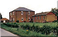
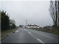
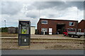
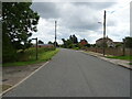
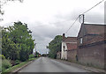
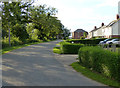
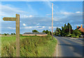
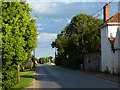
Area Overview for Friskney Eaudyke
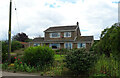
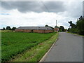
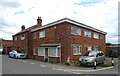
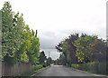
Photos of Friskney Eaudyke
Area Information
Friskney Eaudyke is a compact built-up area in England, spanning 34 hectares, with a distinct character shaped by its older population and rural setting. The area’s median age of 70 suggests a community predominantly composed of retirees or long-term residents, which influences the pace of life and local services. Home ownership is high at 71%, indicating a stable, settled population. Living here means a slower rhythm of life, with proximity to nearby towns and amenities. The small size of the area means daily needs are often within walking distance, though residents may rely on nearby towns for broader services. Friskney Eaudyke’s charm lies in its quiet, unassuming nature, offering a contrast to busier urban centres. For those seeking a peaceful, low-maintenance lifestyle, this area provides a foundation of stability, though it may lack the vibrancy of larger towns. The presence of three railway stations within practical reach adds convenience for commuters, connecting residents to nearby hubs without the need for a car.
- Area Type
- Built Up Area 250
- Area Size
- 34.0 hectares
- Population
- Not available
- Population Density
- Not available
Friskney Eaudyke offers a simple yet functional lifestyle, with essential amenities within practical reach. Three railway stations—Wainfleet, Thorpe Culvert, and Havenhouse—provide direct access to regional transport networks, making commuting efficient. Locally, three retail outlets, including Co-op Wainfleet and Lincolnshire Co-operative Co, offer basic shopping needs, though the selection is limited compared to larger towns. The area’s small size means that most daily errands can be completed without a car, fostering a walkable environment. While there is no mention of parks or leisure facilities in the data, the proximity to rail and retail suggests a focus on practicality over leisure. For residents prioritising convenience and connectivity over expansive amenities, Friskney Eaudyke delivers a straightforward, low-maintenance lifestyle.
Amenities
Schools
| Rank | A + A* % | School | Type | Entry gender | Ages |
|---|
Explore more schools in this area
Go to Schools tabDemographics
Friskney Eaudyke’s population is defined by its median age of 70, the highest in the dataset, suggesting a community dominated by older adults. This demographic profile influences the area’s dynamics, with services and amenities likely tailored to the needs of an aging population. Home ownership is strong, with 71% of households owning their homes, reflecting a stable, long-term resident base. The data does not specify household composition or ethnic diversity, but the high home ownership rate implies a community with fewer transient residents. The absence of detailed figures on accommodation types or diversity means the area’s social fabric remains less defined in the data. For those considering Friskney Eaudyke, the demographic profile suggests a quiet, mature environment, though it may not cater to families with young children or those seeking a more diverse community.
Household Size
Accommodation Type
Tenure
Ethnic Group
Religion
Household Composition
Age
Household Deprivation
NS-SEC
Explore more demographic insights in this area
Go to Demographics tabPlanning
Planning Constraints
- Crime RiskLocked