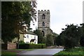
Area Overview for Friskney
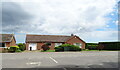
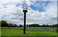
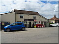
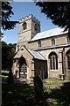
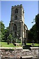
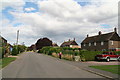
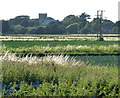
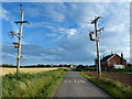
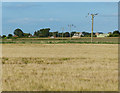
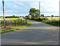
Photos of Friskney
Area Information
Friskney is a compact built-up area in England, covering 26.9 hectares. Its small size means it is not a sprawling town but a focused community. The area’s population is predominantly older, with a median age of 70, suggesting a mature demographic profile. This is reflected in the local character, where daily life is likely to revolve around familiar routines and established social networks. Friskney’s proximity to three railway stations—Wainfleet, Thorpe Culvert, and Havenhouse—offers practical transport links, while nearby retail options like Co-op Wainfleet provide basic amenities. The presence of two primary schools, including one with an Ofsted rating of ‘good’, indicates a commitment to education. For those considering living in Friskney, the area’s compact nature and accessible transport make it suitable for those prioritising convenience over sprawling urban spaces. However, the broadband score of 18, which is poor, may pose challenges for those reliant on high-speed internet.
- Area Type
- Built Up Area 250
- Area Size
- 26.9 hectares
- Population
- Not available
- Population Density
- Not available
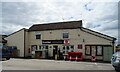
Friskney’s lifestyle is defined by its practical amenities and compact size. Nearby retail options include Co-op Wainfleet and Lincolnshire Co-operative Co, offering essential shopping needs. The three railway stations provide access to broader regional networks, facilitating travel for work or leisure. While the area lacks detailed data on parks or leisure facilities, the presence of schools and retail hubs suggests a focus on basic community needs. The limited broadband quality may restrict online leisure activities, but mobile coverage supports connectivity. Overall, Friskney’s lifestyle is suited to those prioritising convenience, proximity to transport, and a mature, settled community.
Amenities
Schools
Friskney has two primary schools: Friskney All Saints Church of England (Aided) Primary School and Friskney All Saints Church of England Primary School, the latter of which holds an Ofsted rating of ‘good’. A third school, Friskney Private School, is an independent institution. The presence of both state and independent options provides families with choices, though the data does not indicate the size or resources of these schools. The ‘good’ rating at one primary school suggests a quality education option, but the overall school landscape is limited to primary levels, with no mention of secondary institutions. For families prioritising education, Friskney’s schools are a practical asset, though the absence of detailed performance metrics or student numbers means further inquiry is necessary.
| Rank | School | Type | Entry gender | Ages |
|---|
Explore more schools in this area
Go to Schools tabDemographics
Friskney’s population has a median age of 70, the highest in the dataset, suggesting a community skewed towards older residents. This demographic profile may influence local services and amenities, with a focus on healthcare and retirement-focused infrastructure. Home ownership stands at 71%, indicating a majority of residents live in properties they own, which can contribute to a stable, long-term community feel. The data does not specify household composition or ethnic diversity, but the ‘total’ category for both suggests a lack of detailed breakdowns. The absence of specific figures on deprivation or income levels means it is difficult to assess the area’s economic challenges or opportunities. For prospective buyers, the high median age and strong home ownership rate imply a mature, settled population, though the lack of demographic detail leaves gaps in understanding the community’s full composition.
Household Size
Accommodation Type
Tenure
Ethnic Group
Religion
Household Composition
Age
Household Deprivation
NS-SEC
Explore more demographic insights in this area
Go to Demographics tabPlanning
Planning Constraints
- Crime RiskPremium